Kernohan | |
|---|---|
Neighbourhood | |
 Kernohan Location of Kernohan in Edmonton | |
| Coordinates: 53°35′49″N 113°22′48″W / 53.597°N 113.380°W | |
| Country | |
| Province | |
| City | Edmonton |
| Quadrant[1] | NW |
| Ward[1] | Dene |
| Sector[2] | Northeast |
| Area[3][4] | Clareview |
| Government | |
| • Administrative body | Edmonton City Council |
| • Councillor | Aaron Paquette |
| Area | |
| • Total | 0.89 km2 (0.34 sq mi) |
| Elevation | 651 m (2,136 ft) |
| Population (2012)[7] | |
| • Total | 3,081 |
| • Density | 3,461.8/km2 (8,966/sq mi) |
| • Change (2009–12) | |
| • Dwellings | 1,188 |
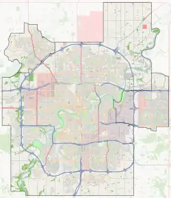
Kernohan is a residential neighbourhood located in the Clareview area of north east Edmonton, Alberta, Canada. It is "named for an early pioneer farmer who operated a grocery store here in the 1880s and 90s.[8]
The neighbourhood is bounded on the west by Victoria Trail and on the north by 137 Avenue. To the east is the North Saskatchewan River valley. To the south the neighbourhood overlooks Kennedale Ravine.
While residential development began during the 1960s, according to the 2001 federal census, just over half (53.8%) of all residences were built during the 1970s. One residence in ten (10.9%) were built during the 1980s. Three residences in ten (27.3%) were built during the 1990s.[9]
The most common type of residence in the neighbourhood, according to the 2005 municipal census, is the single-family dwelling. These account for roughly three out of every five (62%) of all residences in the neighbourhood. Row houses account for another one residence in five (20%). Another one in eight (12%) residences are Duplexes.[10] The remaining 5% are apartment style condominiums in low-rise buildings with fewer than five stories. Nine out of every ten (89.6%) residences are owner-occupied, with only one residence in ten (10.4%) being rented.[11]
There is a single school in the neighbourhood, Anne Fitzgerald Catholic Elementary School, operated by the Edmonton Catholic School System.
Clareview LRT Station is located to the west of the neighbourhood along 137 Avenue.
Demographics
In the City of Edmonton's 2012 municipal census, Kernohan had a population of 3,081 living in 1,188 dwellings,[7] a -2.5% change from its 2009 population of 3,160.[12] With a land area of 0.89 km2 (0.34 sq mi),[6] it had a population density of 3,461.8 people/km2 in 2012.[6][7]
Surrounding neighbourhoods
References
- 1 2 "City of Edmonton Wards & Standard Neighbourhoods" (PDF). City of Edmonton. Archived from the original (PDF) on May 3, 2014. Retrieved February 13, 2013.
- ↑ "Edmonton Developing and Planned Neighbourhoods, 2011" (PDF). City of Edmonton. Archived from the original (PDF) on September 4, 2013. Retrieved February 13, 2013.
- ↑ "The Way We Grow: Municipal Development Plan Bylaw 15100" (PDF). City of Edmonton. 2010-05-26. Archived from the original (PDF) on May 2, 2015. Retrieved February 13, 2013.
- ↑ "City of Edmonton Plans in Effect" (PDF). City of Edmonton. November 2011. Archived from the original (PDF) on October 17, 2013. Retrieved February 13, 2013.
- ↑ "City Councillors". City of Edmonton. Archived from the original on March 28, 2013. Retrieved February 13, 2013.
- 1 2 3 "Neighbourhoods (data plus kml file)". City of Edmonton. Archived from the original on May 12, 2012. Retrieved February 22, 2013.
- 1 2 3 "Municipal Census Results – Edmonton 2012 Census". City of Edmonton. Archived from the original on January 25, 2013. Retrieved February 22, 2013.
- ↑ From the neighbourhood description in the City of Edmonton Map Utility Archived 2006-09-02 at the Wayback Machine.
- ↑ "Archived copy" (PDF). Archived (PDF) from the original on 2008-04-10. Retrieved 2007-12-16.
{{cite web}}: CS1 maint: archived copy as title (link) - ↑ Duplexes include triplexes and fourplexes.
- ↑ "Archived copy" (PDF). Archived (PDF) from the original on 2008-04-10. Retrieved 2007-12-16.
{{cite web}}: CS1 maint: archived copy as title (link) - ↑ "2009 Municipal Census Results". City of Edmonton. Archived from the original on May 31, 2013. Retrieved February 22, 2013.