Khash
Persian: خاش | |
|---|---|
City | |
 Khash | |
| Coordinates: 28°13′12″N 61°12′41″E / 28.22000°N 61.21139°E[1] | |
| Country | |
| Province | Sistan and Baluchestan |
| County | Khash |
| District | Central |
| Population (2016)[2] | |
| • Total | 56,584 |
| Time zone | UTC+3:30 (IRST) |
Khash (Persian: خاش (Xāŝ), also Romanized as Khāsh, Kavash, and Kwāsh; also known as Vāsht)[3] is a city in the Central District of Khash County, Sistan and Baluchestan province, Iran, serving as capital of both the county and the district.[4]
At the 2006 census, its population was 56,683 in 10,176 households.[5] The following census in 2011 counted 54,105 people in 11,721 households.[6] The latest census in 2016 showed a population of 56,584 people in 14,384 households.[2]
The overwhelming majority of the city's inhabitants are ethnic Baloch who speak the Balochi language, and Persians who speak a variant of the Persian language known as Sistani or Seistani which is very similar to Dari, also known as Afghan Persian. It is located at an altitude of 1,400 metres (4596 feet).[7]
On 16 April 2013, an earthquake of magnitude 7.8 struck the Iran-Pakistan border near Balochistan. The epicenter of the earthquake was at Khash.[8]
On 4 November 2022, security forces fired on protestors in Khash, with about 30 people killed or injured.[9] An entire commercial district was set on fire during the unrest.[9]
Khash also is the point of origin for the abnormally high incidence of Factor XIII deficiency, an extremely serious genetic bleeding disorder in Iran; it is more than 100 times more prevalent in Iran than anywhere else due to the high degree of consanguineous marriage.[10]
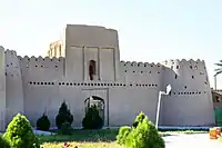
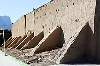
 Heydar Abad Castle
 Heydar Abad Castle
References
- ↑ OpenStreetMap contributors (12 April 2023). "Khash, Khash County" (Map). OpenStreetMap. Retrieved 12 April 2023.
- 1 2 "Census of the Islamic Republic of Iran, 1395 (2016)". AMAR (in Persian). The Statistical Center of Iran. p. 11. Archived from the original (Excel) on 23 December 2021. Retrieved 19 December 2022.
- ↑ Khash, Iran can be found at GEOnet Names Server, at this link, by opening the Advanced Search box, entering "-3070822" in the "Unique Feature Id" form, and clicking on "Search Database".
- ↑ Habibi, Hassan (21 June 1369). "Approval of the organization and chain of citizenship of the elements and units of the national divisions of Sistan and Baluchestan province, centered in the city of Zahedan". Research Center of the System of Laws of the Islamic Council of the Farabi Library of Mobile Users (in Persian). Ministry of Interior, Defense Political Commission of the Government Board. Archived from the original on 24 July 2013. Retrieved 29 December 2023.
- ↑ "Census of the Islamic Republic of Iran, 1385 (2006)". AMAR (in Persian). The Statistical Center of Iran. p. 11. Archived from the original (Excel) on 20 September 2011. Retrieved 25 September 2022.
- ↑ "Census of the Islamic Republic of Iran, 1390 (2011)". Syracuse University (in Persian). The Statistical Center of Iran. p. 11. Archived from the original (Excel) on 25 November 2022. Retrieved 19 December 2022.
- ↑ Location of Khash - Falling Rain Genomics
- ↑ "undefined".
- 1 2 Daragahi, Borzou (4 November 2022). "'Death to the dictator': Dozens killed as Iran's southeast erupts in political violence". The Independent. Retrieved 6 November 2022.
- ↑ "Effect of Social Factors on the Highest Global Incidence of Factor XIII Deficiency in Southeast of Iran". Archives of Iranian Medicine. 2 (5). January 2015 – via researchgate.net.
