Kilmanaghan
Cill Mhancháin | |
|---|---|
 Kilmanaghan | |
| Coordinates: 53°22′55″N 7°41′17″W / 53.38194°N 7.68806°W | |
| Country | Ireland |
| Province | Leinster |
| County | County Westmeath and County Offaly |
| Irish grid reference | N208368 |
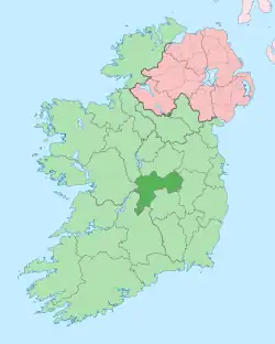
Kilmanaghan (Irish: Cill Mhancháin, meaning 'Manchan’s church')[1][2] is a civil parish which spans the counties of Offaly and Westmeath in Ireland. It is located about 27.76 kilometres (17 mi) south–west of Mullingar and 17.52 kilometres (11 mi) north–west of Tullamore.
Geography
Kilmanaghan is one of four civil parishes in the barony of Clonlonan (Westmeath) and 4 civil parishes in the barony of Kilcoursey (Offaly), both in the Province of Leinster. The civil parish covers 8,204.5 acres (33.202 km2), 1,635.1 acres (6.617 km2) in County Westmeath and 6,569.4 acres (26.585 km2) in County Offaly.
Kilmanaghan civil parish comprises the town of Moate, 10 townlands in County Westmeath and 22 Townlands in County Offaly.
The neighbouring civil parishes are: Ballyloughloe and Kilcumreragh to the north, Ardnurcher or Horseleap and Kilbride to the east, Lemanaghan and Rahan to the south and Kilcleagh to the west.[3][4][5]
References
- ↑ Kilmanaghan civil parish The Placenames Database of Ireland. Retrieved on 24 July 2015.
- ↑ Joyce, P. W. (Patrick Weston) (1913). Irish names of places (PDF). Vol. v.3. Dublin : Phoenix. p. 424.
- ↑ Kilmanaghan civil parish, Co. Westmeath townlands.ie Retrieved on 24 July 2015.
- ↑ Kilmanaghan civil parish, Co. Offaly townlands.ie Retrieved on 24 July 2015.
- ↑ Kilmanaghan civil parish, Co. Westmeath The IreAtlas Townland Data Base. Retrieved on 24 July 2015.
External links
- Kilmanaghan civil parish at the IreAtlas Townland Data Base
- Kilmanaghan civil parish, County Westmeath at townlands.ie
- Kilmanaghan civil parish, County Offaly at townlands.ie
- Kilmanaghan civil parish, County Westmeath at The Placenames Database of Ireland
- Kilmanaghan civil parish, County Offaly at The Placenames Database of Ireland

