La Celle-sous-Gouzon | |
|---|---|
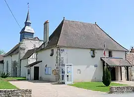 The town hall and the priory in La Celle-sous-Gouzon | |
Location of La Celle-sous-Gouzon | |
 La Celle-sous-Gouzon  La Celle-sous-Gouzon | |
| Coordinates: 46°12′56″N 2°12′39″E / 46.2156°N 2.2108°E | |
| Country | France |
| Region | Nouvelle-Aquitaine |
| Department | Creuse |
| Arrondissement | Aubusson |
| Canton | Gouzon |
| Intercommunality | CC Creuse Confluence |
| Government | |
| • Mayor (2020–2026) | Michaël Jouanneton[1] |
| Area 1 | 14.07 km2 (5.43 sq mi) |
| Population | 155 |
| • Density | 11/km2 (29/sq mi) |
| Time zone | UTC+01:00 (CET) |
| • Summer (DST) | UTC+02:00 (CEST) |
| INSEE/Postal code | 23040 /23230 |
| Elevation | 375–438 m (1,230–1,437 ft) (avg. 430 m or 1,410 ft) |
| 1 French Land Register data, which excludes lakes, ponds, glaciers > 1 km2 (0.386 sq mi or 247 acres) and river estuaries. | |
La Celle-sous-Gouzon (French pronunciation: [la sɛl su ɡuzɔ̃], literally La Celle under Gouzon; Occitan: La Cela de Gosom) is a commune in the Creuse department in the Nouvelle-Aquitaine region in central France.
Geography
A farming area comprising the village and a few small hamlets situated some 16 miles (26 km) east of Guéret on the D40 road.
Population
| Year | Pop. | ±% |
|---|---|---|
| 1962 | 229 | — |
| 1968 | 232 | +1.3% |
| 1975 | 226 | −2.6% |
| 1982 | 203 | −10.2% |
| 1990 | 162 | −20.2% |
| 1999 | 138 | −14.8% |
| 2008 | 140 | +1.4% |
Sights
- The church of St. Pierre and St. Paul, dating from the fifteenth century.
See also
References
- ↑ "Répertoire national des élus: les maires". data.gouv.fr, Plateforme ouverte des données publiques françaises (in French). 9 August 2021.
- ↑ "Populations légales 2021". The National Institute of Statistics and Economic Studies. 28 December 2023.
Wikimedia Commons has media related to La Celle-sous-Gouzon.
This article is issued from Wikipedia. The text is licensed under Creative Commons - Attribution - Sharealike. Additional terms may apply for the media files.