La Ferté-Saint-Cyr | |
|---|---|
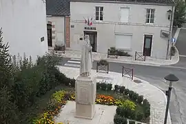 Statue and town hall | |
Location of La Ferté-Saint-Cyr | |
 La Ferté-Saint-Cyr  La Ferté-Saint-Cyr | |
| Coordinates: 47°39′24″N 1°40′30″E / 47.6567°N 1.675°E | |
| Country | France |
| Region | Centre-Val de Loire |
| Department | Loir-et-Cher |
| Arrondissement | Blois |
| Canton | Chambord |
| Intercommunality | Grand Chambord |
| Government | |
| • Mayor (2020–2026) | Anne-Marie Thomas[1] |
| Area 1 | 57.93 km2 (22.37 sq mi) |
| Population | 1,058 |
| • Density | 18/km2 (47/sq mi) |
| Time zone | UTC+01:00 (CET) |
| • Summer (DST) | UTC+02:00 (CEST) |
| INSEE/Postal code | 41085 /41220 |
| Elevation | 78–131 m (256–430 ft) (avg. 86 m or 282 ft) |
| 1 French Land Register data, which excludes lakes, ponds, glaciers > 1 km2 (0.386 sq mi or 247 acres) and river estuaries. | |
La Ferté-Saint-Cyr (French: [la fɛʁte sɛ̃ siʁ]) is a commune near Blois, in the Loir-et-Cher department in Centre-Val de Loire, France.[3]
Geography
The commune is traversed by the Cosson river.
Population
| Year | Pop. | ±% p.a. |
|---|---|---|
| 1968 | 737 | — |
| 1975 | 745 | +0.15% |
| 1982 | 774 | +0.55% |
| 1990 | 809 | +0.55% |
| 1999 | 894 | +1.12% |
| 2007 | 966 | +0.97% |
| 2012 | 1,042 | +1.53% |
| 2017 | 1,056 | +0.27% |
| Source: INSEE[4] | ||
See also
References
- ↑ "Répertoire national des élus: les maires" (in French). data.gouv.fr, Plateforme ouverte des données publiques françaises. 13 September 2022.
- ↑ "Populations légales 2021". The National Institute of Statistics and Economic Studies. 28 December 2023.
- ↑ INSEE commune file
- ↑ Population en historique depuis 1968, INSEE
Wikimedia Commons has media related to La Ferté-Saint-Cyr.
This article is issued from Wikipedia. The text is licensed under Creative Commons - Attribution - Sharealike. Additional terms may apply for the media files.