Mur-de-Sologne | |
|---|---|
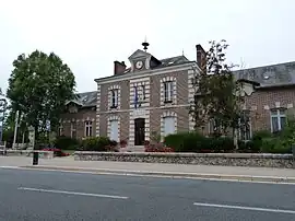 Town hall | |
Location of Mur-de-Sologne | |
 Mur-de-Sologne  Mur-de-Sologne | |
| Coordinates: 47°24′48″N 1°36′33″E / 47.4133°N 1.6092°E | |
| Country | France |
| Region | Centre-Val de Loire |
| Department | Loir-et-Cher |
| Arrondissement | Romorantin-Lanthenay |
| Canton | Selles-sur-Cher |
| Government | |
| • Mayor (2022–2026) | Yves Villanueva[1] |
| Area 1 | 50.5 km2 (19.5 sq mi) |
| Population | 1,513 |
| • Density | 30/km2 (78/sq mi) |
| Time zone | UTC+01:00 (CET) |
| • Summer (DST) | UTC+02:00 (CEST) |
| INSEE/Postal code | 41157 /41230 |
| Elevation | 88–131 m (289–430 ft) (avg. 113 m or 371 ft) |
| 1 French Land Register data, which excludes lakes, ponds, glaciers > 1 km2 (0.386 sq mi or 247 acres) and river estuaries. | |
Mur-de-Sologne (French pronunciation: [myʁ də sɔlɔɲ], literally Mur of Sologne) is a commune in the Loir-et-Cher department of central France.[3]
Population
| Year | Pop. | ±% p.a. |
|---|---|---|
| 1968 | 925 | — |
| 1975 | 1,017 | +1.36% |
| 1982 | 1,102 | +1.15% |
| 1990 | 1,054 | −0.56% |
| 1999 | 1,197 | +1.42% |
| 2007 | 1,305 | +1.09% |
| 2012 | 1,496 | +2.77% |
| 2017 | 1,519 | +0.31% |
| Source: INSEE[4] | ||
See also
References
- ↑ "Répertoire national des élus: les maires" (in French). data.gouv.fr, Plateforme ouverte des données publiques françaises. 6 June 2023.
- ↑ "Populations légales 2021". The National Institute of Statistics and Economic Studies. 28 December 2023.
- ↑ INSEE commune file
- ↑ Population en historique depuis 1968, INSEE
Wikimedia Commons has media related to Mur-de-Sologne.
This article is issued from Wikipedia. The text is licensed under Creative Commons - Attribution - Sharealike. Additional terms may apply for the media files.