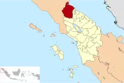
Langkat Regency
لڠكت | |
|---|---|
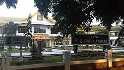 The Langkat regent's office | |
 Coat of arms | |
 | |
| Country | Indonesia |
| Province | North Sumatra |
| Regency seat | Stabat |
| Government | |
| • Acting Regent | Syah Afandin |
| • Chairman of Regency's Council of Representatives | Surialam (Golkar) |
| • Vice Chairmen of Regency's Council of Representatives | Donny Setha (Gerindra), Ralin Sinulingga (PDI-P) and Antoni Ginting (National Mandate Party) |
| Area | |
| • Total | 6,273.29 km2 (2,422.13 sq mi) |
| Population (mid 2022 estimate)[1] | |
| • Total | 1,039,926 |
| • Density | 170/km2 (430/sq mi) |
| Time zone | UTC+7 (WIB) |
| Website | www |
Langkat Regency (Indonesian: Kabupaten Langkat) is the northernmost regency of North Sumatra. Its seat is Stabat. Its area is 6,263.29 km2 and its population was 967,535 at the 2010 Census[2] and 1,030,202 at the 2020 Census;[3] the official estimate as at mid 2022 was 1,039,926.[1]
Immediately to the south is Karo Regency, to the east is Deli Serdang Regency (which surrounds the city of Medan) and the city of Binjai (formerly part of Langkat Regency), to the northeast lies the Strait of Malacca and to the west lies Aceh Province.
Administrative districts
Langkat Regency is divided into twenty-three administrative districts (Indonesian: kecamatan), tabulated below with their areas and their populations at the 2010 Census[2] and the 2020 Census,[3] together with the official estimates as at mid 2022.[1] The table also includes the locations of the district administrative centres, the number of administrative villages in each district (totaling 240 rural desa and 37 urban kelurahan), and its post code.
| Kode Wilayah | Name of District (kecamatan) | Area in km2 | Pop'n Census 2010 | Pop'n Census 2020 | Pop'n Estimate | Admin centre | No. of kelurahan | No. of desa | Post code |
|---|---|---|---|---|---|---|---|---|---|
| 12.05.01 | Bahorok | 1,101.83 | 39,851 | 41,570 | 41,812 | Pekan Bahorok | 1 | 18 | 20774 |
| 12.05.21 | Sirapit | 98.50 | 15,908 | 16,703 | 16,821 | Sidorejo | - | 10 | 20775 |
| 12.05.02 | Salapian | 221.73 | 25,924 | 26,238 | 26,386 | Minta kasih | 1 | 16 | 20777 |
| 12.05.22 | Kutambaru | 236.84 | 13,425 | 14,109 | 14,160 | Kutambaru | - | 8 | 20773 |
| 12.05.04 | Sei Bingai | 333.17 | 48,346 | 51,617 | 51,949 | Namu Ukur | 1 | 15 | 20771 |
| 12.05.03 | Kuala | 206.23 | 39,125 | 40,327 | 40,635 | Pekan Kuala | 2 | 14 | 20772 |
| 12.05.06 | Selesai | 167.73 | 69,324 | 72,595 | 73,073 | Pekan Selesai | 1 | 13 | 20762 |
| 12.05.05 | Binjai (a) | 42.05 | 42,325 | 47,018 | 47,774 | Kuala Begumit | 1 | 6 | 20761 |
| 12.05.07 | Stabat | 108.85 | 81,971 | 91,153 | 92,633 | Stabat Binjai | 6 | 6 | 20811 -20816 |
| 12.05.08 | Wampu | 194.21 | 40,612 | 42,388 | 42,639 | Bingai | 1 | 13 | 20851 |
| 12.05.19 | Batang Serangan | 899.38 | 35,019 | 35,764 | 35,894 | Pekan Batang Serangan | 1 | 7 | 20852 |
| 12.05.20 | Sawit Seberang | 209.10 | 25,197 | 25,765 | 25,894 | Pekan Sawit Seberang | 1 | 6 | 20811 |
| 12.05.12 | Padang Tualang | 221.14 | 46,687 | 52,895 | 53,869 | Tanjung Selamat | 1 | 11 | 20850 |
| 12.05.10 | Hinai | 105.26 | 47,843 | 52,664 | 53,525 | Kebun Lada | 1 | 12 | 20854 |
| 12.05.09 | Secanggang | 231.19 | 65,349 | 70,482 | 71,352 | Hinai Kiri | 1 | 16 | 20855 |
| 12.05.11 | Tanjung Pura | 179.61 | 64,412 | 69,018 | 69,781 | Pekan Tanjung Pura | 1 | 18 | 20853 |
| 12.05.13 | Gebang (b) | 178.49 | 42,587 | 47,509 | 47,872 | Pekan Gebang | 1 | 10 | 20856 |
| 12.05.14 | Babalan | 76.41 | 56,456 | 56,706 | 56,957 | Pelawi Utara | 4 | 4 | 20857 |
| 12.05.17 | Sei Lepan | 280.68 | 46,810 | 49,630 | 50,076 | Alor Dua | 5 | 9 | 20776 |
| 12.05.18 | Brandan Barat (West Brandan) | 89.80 | 21,905 | 24,398 | 24,197 | Tangkahan Durian | 2 | 5 | 20881 |
| 12.05.16 | Besitang | 720.74 | 43,958 | 45,286 | 45,440 | Pekan Besitang | 3 | 6 | 20859 |
| 12.05.15 | Pangkalan Susu (c) | 151.35 | 41,512 | 43,873 | 44,240 | Bukit Petai | 2 | 9 | 20858 |
| 12.05.23 | Pematang Jaya | 209.00 | 12,992 | 12,869 | 12,916 | Limau Mungkur | - | 8 | 20858 -20859 |
| Totals | 6,263.29 | 967,535 | 1,030,202 | 1,039,926 | 37 | 240 |
Notes: (a) adjacent to, but not part of, Binjai city. (b) includes the offshore island of Pulau Selingkar.
(c) includes the offshore islands of Pulau Kampai, Pulau Panjang, Pulau Rawa and Pulau Sembilan.
References

3°46′N 98°13′E / 3.767°N 98.217°E