Pakpak Bharat Regency
(Kabupaten Pakpak Bharat) | |
|---|---|
.jpg.webp) Regent's office of Pakpak Bharat | |
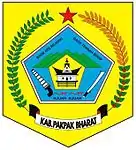
 Coat of arms | |
| Motto: Bage Ate Rejekki Bage Tennah Mo Sodip | |
 | |
| Country | Indonesia |
| Province | North Sumatra |
| Regency seat | Salak |
| Government | |
| • Regent | Asren Nasution (Acting) |
| • Chairman of Regency's Council of Representatives | Sonni P Berutu (Partai Demokrat) |
| • Vice Chairmen of Regency's Council of Representatives | Elson Angkat (Golkar) and Mansehat Manik (Gerindra) |
| Area | |
| • Total | 1,218.30 km2 (470.39 sq mi) |
| Population (mid 2022 estimate)[1] | |
| • Total | 54,609 |
| • Density | 45/km2 (120/sq mi) |
| Demographics | |
| • Religion | Christianism 57,54% –Protestantism 53,45% –Catholicism 4,09% Islam 42,46% |
| Time zone | UTC+7 (WIB) |
| Website | www |
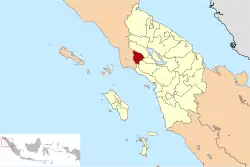
Pakpak Bharat Regency is a landlocked regency in North Sumatra, Indonesia. It was created on 25 February 2003 from the southern districts of Dairi Regency. The regency covers an area of 1,218.3 square kilometres and it had a population of 40,481 at the 2010 census[3] and 52,351 at the 2020 Census;[4] the official estimate as at mid 2022 was 54,609.[1] Its seat is the town of Salak. It is the least populated regency in North Sumatra. Its population is roughly the same as Greenland, the island with the lowest population density in the world.
Administrative districts
The regency is divided administratively into eight districts (kecamatan), tabulated below with their reas and their populations at the 2010 Census[3] and the 2020 Census,[4] together with the official estimates as at mid 2022.[1] The table also includes the locations of the district administrative centres, the number of administrative villages (all classed as rural desa) in each district and its post code.
| Kode Wilayah | Name of District (kecamatan) | Area in km2 | Pop'n Census 2010 | Pop'n Census 2020 | Pop'n Estimate mid 2022 | Admin centre | No. of villages | Post code |
|---|---|---|---|---|---|---|---|---|
| 12.15.03 | Salak | 245.57 | 7,216 | 10,057 | 10,648 | Salak | 6 | 22272 |
| 12.15.01 | Sitellu Tali Ureng Jehe | 473.62 | 9,365 | 11,486 | 11,863 | Sibande | 10 | 22275 |
| 12.15.06 | Pagindar | 75.45 | 1,211 | 1,476 | 1,523 | Pagindar | 4 | 22270 |
| 12.15.04 | Sitellu Tali Ureng Julu | 53.02 | 3,376 | 4,321 | 4,500 | Ulu Merah | 5 | 22276 |
| 12.15.05 | Pergetteng-Getteng Sengkut | 66.64 | 3,740 | 4,751 | 4,941 | Kecupak | 5 | 22273 |
| 12.15.02 | Kerajaan | 147.61 | 8,115 | 10,078 | 10,434 | Sukarame | 10 | 22271 |
| 12.15.07 | Tinada | 74.03 | 3,639 | 4,827 | 5,062 | Tinada | 6 | 22277 |
| 12.15.08 | Siempat Rube | 82.36 | 3,843 | 5,355 | 5,638 | Jambu Rea | 6 | 22274 |
| Totals | 1,218.30 | 40,505 | 52,351 | 54,609 | Salak | 52 |
Demographics
Etnhic groups
The tribes that inhabit Pakpak Bharat Regency in general are Pakpak people. Besides Pakpak, other Batak ethnicities include Toba and Karo; there are also other tribes such as Malay and Nias and so on.
Most of the territory of Pakpak Bharat Regency is the ulayat land of the Pakpak people Suak Simsim, so the majority of Pakpak clan in Pakpak Bharat Regency are from Suak Simsim. However, there are also other Pakpak clans from the other four asylums.
The Pakpak clans inhabiting Pakpak Bharat Regency include:
- Bancin
- Banurea
- Berutu
- Boangmanalu
- Cibro
- Kabeakan
- Kesogihen
- Limbong
- Manik
- Padang
- Padang Batanghari
- Sinamo
- Sitakar
- Solin
- Tinendung
Religion
Religious composition in Pakpak Bharat Regency.[5]
The number of houses of worship by type of places of worship in 2016 in Pakpak Bharat Regency is as follows:
In Pakpak Bharat Regency, Christianity is the religion with the majority of the population, followed by adherents of the Islam religion which also has a large population. There are a total of 189 places of worship (111 churches (98 Protestant and 13 Catholic)), and 78 mosques.
residents of Pakpak Bharat Regency who are Protestant Christians are members of the Church GKPPD.
References
- 1 2 3 Badan Pusat Statistik, Jakarta, 2023, Kabupaten Pakpak Bharat Dalam Angka 2023 (Katalog-BPS 1102001.1215)
- ↑ "Penduduk Menurut Wilayah dan Agama yang Dianut di Kabupaten Pakpak Bharat". sumut.bps.go.id. Retrieved 10 July 2021.
- 1 2 Biro Pusat Statistik, Jakarta, 2011.
- 1 2 Badan Pusat Statistik, Jakarta, 2021.
- ↑ "Badan Pusat Statistik Provinsi Sumatera Utara". sumut.bps.go.id.
2°34′00″N 98°17′00″E / 2.5667°N 98.2833°E
