Le Goulet | |
|---|---|
 | |
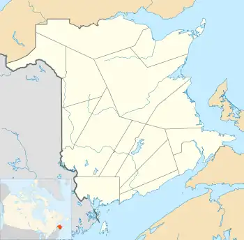
 Le Goulet Location within New Brunswick. | |
| Coordinates: 47°42′N 64°43′W / 47.700°N 64.717°W | |
| Country | Canada |
| Province | New Brunswick |
| County | Gloucester |
| Parish | Shippagan |
| Town | Shippagan |
| Incorporated | 1986 |
| Area | |
| • Land | 5.40 km2 (2.08 sq mi) |
| Population (2021)[1] | |
| • Total | 749 |
| • Density | 138.6/km2 (359/sq mi) |
| • Change (2016–21) | |
| • Dwellings | 339 |
| Time zone | UTC-4 (AST) |
| • Summer (DST) | UTC-3 (ADT) |
| Postal code(s) | |
| Area code | 506 |
| Highways | None |
| Website | www |
Le Goulet is a former village in Gloucester County, New Brunswick, Canada. Located several kilometres east-southeast of downtown Shippagan, it sits on the Gulf of St. Lawrence. Formerly an incorporated village, it is now part of the town of Shippagan.
History
The village was originally called New Jerusalem Settlement when it was initially settled in 1879. Le Goulet was incorporated in 1986.
On 1 January 2023, Le Goulet amalgamated with the town of Shippagan and all or part of seven local service districts to form the new town of Shippagan.[2][3] The community's name remains in official use.[4]
Demographics
| Year | Pop. | ±% |
|---|---|---|
| 1991 | 1,087 | — |
| 1996 | 1,029 | −5.3% |
| 2001 | 969 | −5.8% |
| 2006 | 908 | −6.3% |
| 2011 | 817 | −10.0% |
| 2016 | 793 | −2.9% |
| 2021 | 749 | −5.5% |
In the 2021 Census of Population conducted by Statistics Canada, Le Goulet had a population of 749 living in 321 of its 339 total private dwellings, a change of -5.5% from its 2016 population of 793. With a land area of 5.4 km2 (2.1 sq mi), it had a population density of 138.7/km2 (359.2/sq mi) in 2021.[1]
| 2021 | 2011 | |
|---|---|---|
| Population | 749 (-5.5% from 2016) | 817 (-10.0% from 2006) |
| Land area | 5.40 km2 (2.08 sq mi) | 5.46 km2 (2.11 sq mi) |
| Population density | 138.6/km2 (359/sq mi) | 149.6/km2 (387/sq mi) |
| Median age | 55.6 (M: 54.8, F: 56.8) | 49.5 (M: 48.4, F: 50.6) |
| Private dwellings | 339 (total) 321 (occupied) | 334 (total) |
| Median household income | $72,000 | $.N/A |
Language
| Canada Census Mother Tongue - Le Goulet, New Brunswick[5] | ||||||||||||||||||
|---|---|---|---|---|---|---|---|---|---|---|---|---|---|---|---|---|---|---|
| Census | Total | French |
English |
French & English |
Other | |||||||||||||
| Year | Responses | Count | Trend | Pop % | Count | Trend | Pop % | Count | Trend | Pop % | Count | Trend | Pop % | |||||
2011 |
815 |
805 | 98.77% | 5 | 0.61% | 5 | 0.61% | 0 | 0.00% | |||||||||
2006 |
905 |
890 | 98.34% | 15 | 1.66% | 0 | 0.00% | 0 | 0.00% | |||||||||
2001 |
975 |
955 | 97.95% | 20 | 2.05% | 0 | 0.00% | 0 | 0.00% | |||||||||
1996 |
1,025 |
1,015 | n/a | 99.02% | 10 | n/a | 0.98% | 0 | n/a | 0.00% | 0 | n/a | 0.00% | |||||
Notable people
See also
References
- 1 2 3 "Census Profile of Le Goulet". Statistics Canada. 6 December 2022. Retrieved 17 January 2023.
- ↑ "Local Governments Establishment Regulation – Local Governance Act". Government of New Brunswick. 12 October 2022. Retrieved 11 January 2023.
- ↑ "RSC 4 Acadian Peninsula Regional Service Commission". Government of New Brunswick. Retrieved 17 January 2023.
- ↑ "Proposed entity names reflect strong ties to nature and history" (Press release). Irishtown, New Brunswick: Government of New Brunswick. 25 May 2022. Retrieved 20 January 2023.
- 1 2 Statistics Canada: 1996, 2001, 2006, 2011 census
- ↑ "2021 Community Profiles". 2021 Canadian Census. Statistics Canada. February 4, 2022. Retrieved 2023-10-19.
- ↑ "2011 Community Profiles". 2011 Canadian Census. Statistics Canada. March 21, 2019. Retrieved 2014-04-05.
- ↑ "2006 Community Profiles". 2006 Canadian Census. Statistics Canada. August 20, 2019.
- ↑ "2001 Community Profiles". 2001 Canadian Census. Statistics Canada. July 18, 2021.
External links
- Village de Le Goulet (FR)