Leonardville, Kansas | |
|---|---|
 Location within Riley County and Kansas | |
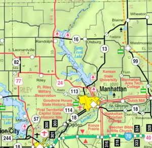 KDOT map of Riley County (legend) | |
| Coordinates: 39°21′51″N 96°51′35″W / 39.36417°N 96.85972°W[1] | |
| Country | United States |
| State | Kansas |
| County | Riley |
| Founded | 1881 |
| Incorporated | 1885 |
| Area | |
| • Total | 0.29 sq mi (0.76 km2) |
| • Land | 0.29 sq mi (0.76 km2) |
| • Water | 0.00 sq mi (0.00 km2) |
| Elevation | 1,388 ft (423 m) |
| Population | |
| • Total | 432 |
| • Density | 1,500/sq mi (570/km2) |
| Time zone | UTC-6 (CST) |
| • Summer (DST) | UTC-5 (CDT) |
| ZIP code | 66449 |
| Area code | 785 |
| FIPS code | 20-39500 |
| GNIS ID | 2395682[1] |
| Website | City Website |
Leonardville is a city in Riley County, Kansas, United States.[1] As of the 2020 census, the population of the city was 432.[3]
History
Leonardville was established in 1881.[4] It was named for Leonard T. Smith, a railroad official.[5][6][7] A post office has been in operation at Leonardville since 1882.[8]
Geography
According to the United States Census Bureau, the city has a total area of 0.28 square miles (0.73 km2), all of it land.[9]
Demographics
| Census | Pop. | Note | %± |
|---|---|---|---|
| 1890 | 410 | — | |
| 1900 | 335 | −18.3% | |
| 1910 | 376 | 12.2% | |
| 1920 | 325 | −13.6% | |
| 1930 | 392 | 20.6% | |
| 1940 | 342 | −12.8% | |
| 1950 | 320 | −6.4% | |
| 1960 | 378 | 18.1% | |
| 1970 | 412 | 9.0% | |
| 1980 | 437 | 6.1% | |
| 1990 | 374 | −14.4% | |
| 2000 | 398 | 6.4% | |
| 2010 | 449 | 12.8% | |
| 2020 | 432 | −3.8% | |
| U.S. Decennial Census | |||
Leonardville is part of the Manhattan, Kansas Metropolitan Statistical Area.
2010 census
As of the census[10] of 2010, there were 449 people, 169 households, and 112 families residing in the city. The population density was 1,603.6 inhabitants per square mile (619.2/km2). There were 195 housing units at an average density of 696.4 per square mile (268.9/km2). The racial makeup of the city was 96.7% White, 0.7% African American, 0.2% Native American, 0.4% from other races, and 2.0% from two or more races. Hispanic or Latino of any race were 4.5% of the population.
There were 169 households, of which 36.1% had children under the age of 18 living with them, 50.3% were married couples living together, 11.2% had a female householder with no husband present, 4.7% had a male householder with no wife present, and 33.7% were non-families. 29.6% of all households were made up of individuals, and 11.9% had someone living alone who was 65 years of age or older. The average household size was 2.37 and the average family size was 2.91.
The median age in the city was 43.4 years. 24.3% of residents were under the age of 18; 3.5% were between the ages of 18 and 24; 25.2% were from 25 to 44; 23.9% were from 45 to 64; and 23.2% were 65 years of age or older. The gender makeup of the city was 45.2% male and 54.8% female.
2000 census
As of the census[11] of 2000, there were 398 people, 167 households, and 114 families residing in the city. The population density was 1,545.7 inhabitants per square mile (596.8/km2). There were 198 housing units at an average density of 769.0 per square mile (296.9/km2). The racial makeup of the city was 98.74% White, 0.25% Native American, 0.50% Asian, and 0.50% from two or more races. Hispanic or Latino of any race were 0.50% of the population.
There were 167 households, out of which 29.9% had children under the age of 18 living with them, 58.1% were married couples living together, 8.4% had a female householder with no husband present, and 31.7% were non-families. 27.5% of all households were made up of individuals, and 13.8% had someone living alone who was 65 years of age or older. The average household size was 2.38 and the average family size was 2.91.
In the city, the population was spread out, with 26.4% under the age of 18, 4.8% from 18 to 24, 28.6% from 25 to 44, 18.3% from 45 to 64, and 21.9% who were 65 years of age or older. The median age was 39 years. For every 100 females, there were 96.1 males. For every 100 females age 18 and over, there were 91.5 males.
The median income for a household in the city was $31,875, and the median income for a family was $38,750. Males had a median income of $26,250 versus $20,469 for females. The per capita income for the city was $16,327. About 4.2% of families and 9.0% of the population were below the poverty line, including 9.4% of those under age 18 and 4.7% of those age 65 or over.
Education
The community is served by Riley County USD 378 public school district.
Notable people
- Quentin Breese (1918–1962), boxer
- Albin Longren (1882–1950), aviation pioneer
- Jordy Nelson (b. 1985), former American football player for the Green Bay Packers
References
- 1 2 3 4 U.S. Geological Survey Geographic Names Information System: Leonardville, Kansas
- ↑ "2019 U.S. Gazetteer Files". United States Census Bureau. Retrieved July 24, 2020.
- 1 2 "Profile of Leonardville, Kansas in 2020". United States Census Bureau. Archived from the original on April 26, 2022. Retrieved April 26, 2022.
- ↑ Kansas State Historical Society (1916). Biennial Report of the Board of Directors of the Kansas State Historical Society. Kansas State Printing Plant. pp. 275.
- ↑ Heim, Michael (2007). Exploring Kansas Highways. p. 80. ISBN 9780974435886.
- ↑ Blackmar, Frank Wilson (1912). Kansas: A Cyclopedia of State History, Volume 2. Standard Publishing Company. pp. 139.
- ↑ Gannett, Henry (1905). The Origin of Certain Place Names in the United States. U.S. Government Printing Office. p. 185.
- ↑ "Riley County". Jim Forte Postal History. Retrieved June 14, 2015.
- ↑ "US Gazetteer files 2010". United States Census Bureau. Archived from the original on July 2, 2012. Retrieved July 6, 2012.
- ↑ "U.S. Census website". United States Census Bureau. Retrieved July 6, 2012.
- ↑ "U.S. Census website". United States Census Bureau. Retrieved January 31, 2008.
External links
Municipalities and communities of Riley County, Kansas, United States | ||
|---|---|---|
| Cities | 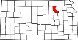 Map of Kansas highlighting Riley County | |
| Unincorporated communities | ||
| Footnotes | †This community is designated a Census-Designated Place (CDP) by the United States Census Bureau. ‡This community also has portions in an adjacent county or counties. | |