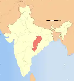
There are 32 districts in the state of Chhattisgarh, which has a total population 25,540,196 as of 2011. Mainly Chhattisgarh(CG) state has large population in cities like Raipur, Raigarh, Bhilai, Korba, Ambikapur, Jagdalpur and Bilaspur. Male and Female population in this state is 12,827,915 and 12,712,281 respectively (as in 2011).[1]

Raipur, The largest city of Chhattisgarh

AIIMS, Raipur
Urban Agglomeration Constituents
Urban Agglomerations constituents with a population above 100,000 as per 2011 census are shown in the table below.[2]
| Urban Agglomeration | Name of Constituent | District | Type* | Population 2011 | Male | Female | Population below 5 yrs |
Literacy Rate |
|---|---|---|---|---|---|---|---|---|
| Raipur | Raipur | Raipur district | M Corp. | 1,010,087 | 519,286 | 490,801 | 124,471 | 85.95% |
| Bhilai-Durg | Bhilai | Durg district | M Corp. | 1,003,406 | 465,644 | 435,585 | 102,175 | 96.17% |
| Bilaspur | Bilaspur | Bilaspur district | M Corp. | 717,030 | 361‚030 | 350‚000 | 37‚552 | 88.13% |
| Korba | Korba | Korba district | M Corp. | 365,253 | 189,989 | 175,264 | 46430 | 84.28% |
| Rajnandgaon | Rajnandgaon | Rajnandgaon district | M Corp. | 163,122 | 83,973 | 80,064 | 26,345 | 93.28% |
| Raigarh | Raigarh district | Raigarh district | M Corp. | 150,019 | 77,973 | 72,046 | 18,444 | 87.55% |
| Jagdalpur | Jagdalpur | Bastar district | M Corp. | 125,463 | 63,989 | 61,474 | 14,185 | 75.31% |
| Ambikapur | Ambikapur | Surguja district | M Corp. | 114,575 | 59,673 | 54,902 | 11,905 | 88.20% |
| Chirmiri | Chirmiri | Manendragarh-Chirmiri-Bharatpur district | M Corp. | 103,575 | 52,673 | 54,902 | 12,995 | 88.80% |
| Dhamtari | Dhamtari | Dhamtari district | M Corp. | 101,677 | 50,807 | 50,870 | 11,652 | 85.31% |
| Mahasamund | Mahasamund | Mahasamund district | M Corp. | 54,413 | 27,093 | 27,320 | 6,621 | 83.67% |
Nagar Panchayats
The list of nagar panchayats and their population(as in 2011) are shown below:[3]
References
- ↑ "जनगणना : शासकीय वेबसाइट छत्तीसगढ़ शासन". Archived from the original on 14 September 2015. Retrieved 1 March 2018.
- ↑ "Cities having population 1 lakh and above" (PDF). Provisional Population Totals, Census of India 2011. Retrieved 16 April 2012.
- ↑ "List of Nagar Panchayats" (PDF). Census India. Retrieved 5 January 2021.
This article is issued from Wikipedia. The text is licensed under Creative Commons - Attribution - Sharealike. Additional terms may apply for the media files.
