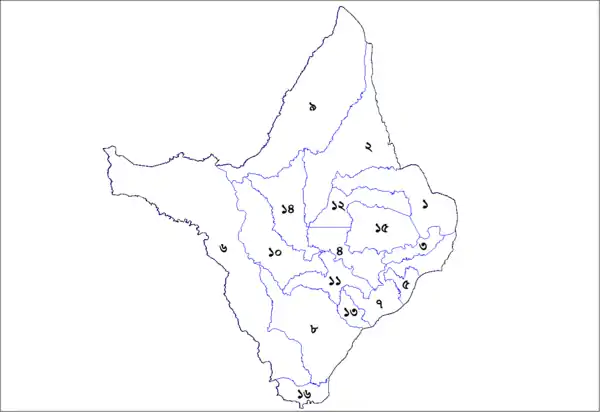
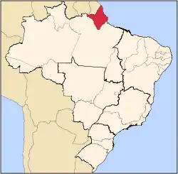
This is a list of the municipalities in the state of Amapá (AP), located in the North Region of Brazil. Amapá is divided into 16 municipalities, which are grouped into 4 microregions, which are grouped into 2 mesoregions.

Municipalities of Amapa, Brazil
| Mesoregion | Microregion | # | Municipality |
|---|---|---|---|
| Norte do Amapá | Amapá | 1 | Amapá |
| 12 | Pracuúba | ||
| 15 | Tartarugalzinho | ||
| Oiapoque | 2 | Calçoene | |
| 9 | Oiapoque | ||
| Sul do Amapá | Macapá | 3 | Cutias |
| 4 | Ferreira Gomes | ||
| 5 | Itaubal | ||
| 7 | Macapá (State Capital) | ||
| 10 | Pedra Branca do Amapari | ||
| 11 | Porto Grande | ||
| 13 | Santana | ||
| 14 | Serra do Navio | ||
| Mazagão | 6 | Laranjal do Jari | |
| 8 | Mazagão | ||
| 16 | Vitória do Jari | ||
Districts
Some municipalities are subdivided in districts.
| Municipality | Districts |
|---|---|
| Amapá | The town of Amapá & Sucuriju.[1] |
| Calçoene | The town of Calçoene, Cunani & Lourenço.[2] |
| Macapá | The city of Macapá, Bailique, Carapanantuba, Fazendinha & São Joaquim do Pacuí.[3] |
| Mazagão | The town of Mazagão, Carvão & Mazagão Velho.[4] |
| Oiapoque | The town of Oiapoque, Clevelândia do Norte & Vila Velha.[5] |
| Santana | The city of Santana, Anauerapucu, Igarapé do Lago, Ilha de Santana, Piaçacá & Pirativa.[6] |
| Serra do Navio | The town of Serra do Navio & Cachaço.[7] |
See also
References
- ↑ "História". IBGE (in Portuguese). Retrieved 31 March 2021.
- ↑ "História". Instituto Brasileiro de Geografia e Estatística (in Portuguese). Retrieved 31 March 2021.
- ↑ "Macapá". IBGE (in Portuguese). Retrieved 1 April 2021.
- ↑ "Mazagão". IBGE (in Portuguese). Retrieved 1 April 2021.
- ↑ "Histórico". Municipality of Oiapoque (in Portuguese). Retrieved 30 March 2021.
- ↑ "Santana". IBGE (in Portuguese). Retrieved 4 April 2021.
- ↑ "Serra do Navio". IBGE (in Portuguese). Retrieved 1 April 2021.
This article is issued from Wikipedia. The text is licensed under Creative Commons - Attribution - Sharealike. Additional terms may apply for the media files.
