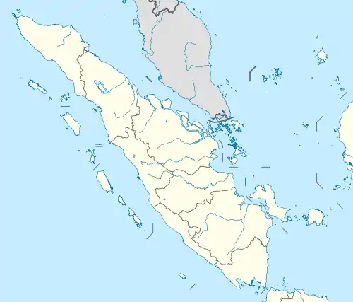
This is a list of rivers flowing in the island of Sumatra, Indonesia.[1]
In alphabetical order
- Aceh
- Asahan
- Banyuasin
- Barumun
- Batang Hari
- Bila
- Bohorok
- Gadis
- Indragiri
- Jamboaye
- Kampar Kanan
- Kampar
- Kluet
- Komering
- Kualu
- Kumu
- Mandau
- Merangin
- Mesuji
- Musi
- Ogan
- Ombilin
- Peureulak
- Peusangen
- Rawas
- Renun
- Rokan
- Rokan-kanan
- Rokan-kiri
- Sekampung
- Seputih
- Siak
- Silau
- Simpang-kanan
- Simpang-kiri
- Sinamar
- Tamiang
- Tembesi
- Teunom
- Toru
- Tripa
- Tulangbawang
- Tungkal
- Wampu
- Woyla
Mouth location
North coast
Northeast coast
Northwest coast
West coast
East coast
Southeast coast

View over the Musi River at night
By Province
Aceh
Jambi
Lampung
North Sumatra
Riau
South Sumatra
West Sumatra
See also
- Drainage basins of Sumatra
- List of drainage basins of Indonesia
References
- ↑ Map of Indonesia. Peta Indonesia. Wawasan Nusantara. CV. Indo Prima Sarana. Accessed 29 Juli 2017.
Sources
- W. van Gelder. Dari Tanah Hindia berkoeliling boemi: kitab pengadjaran ilmoe boemi bagi sekola anak negeri di Hindia-Nederland. J.B. Wolters, 1897.Original from National Library of the Netherlands (original from Leiden University Libraries). Digitized: Nov 5, 2017.
- Wetenschappelijke voordrachten gehouden te Amsterdam in 1883, ter gelegenheid der Koloniale Tentoonstelling. Amsterdam (Netherlands). Koloniale Tentoonstelling, 1883. Uitgegeven door de Vijfde Afdeeling van het Tentoonstellings-bestuur, E. J. Brill, 1884. Cornell University. Digitized: May 22, 2014.
This article is issued from Wikipedia. The text is licensed under Creative Commons - Attribution - Sharealike. Additional terms may apply for the media files.
