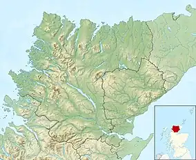
| Loch Culag | |
|---|---|
 Lily pads cover Loch Culag, on the minor road south of Lochinver. | |
 Loch Culag Location in Sutherland | |
| Location | NC09752165 |
| Coordinates | 58°08′34″N 5°14′00″W / 58.14279938°N 5.233224164°W |
| Type | freshwater loch |
| Primary inflows | River River |
| Primary outflows | Amhainn na Culeig |
| Max. length | 0.8040 km (0.4996 mi)[1] |
| Max. width | 0.4023 km (0.2500 mi)[1] |
| Surface area | 15 ha (37 acres)[2] |
| Average depth | 3.60892 ft (1.10000 m)[1] |
| Max. depth | 8.85827 ft (2.70000 m)[1] |
| Water volume | 5,661,258 cu ft (160,309.0 m3)[1] |
| Shore length1 | 3 km (1.9 mi) [2] |
| Surface elevation | 24 m (79 ft)[2] |
| Max. temperature | 50.5 °F (10.3 °C) |
| Min. temperature | 50.1 °F (10.1 °C) |
| Islands | 0 |
| 1 Shore length is not a well-defined measure. | |
Loch Culag also known as Loch na Doire Daraich is a small freshwater shallow loch, located south of Lochinver in the Assynt district of Sutherland, Highland, Scotland.[1][2] The loch is located in an area along with neighbouring Coigach, as the Assynt-Coigach National Scenic Area,[3] one of 40 such areas in Scotland.[4]
Geography
The primary inflow to the loch comes from Loch Druim Suardalain, located three-quarters of a mile to the east, via the short Culag River (Gealic:Amhainn na Culeig), and flows out of Loch Culag and meets the sea in the harbour of Lochinver, a short distance later.[5]
The loch is surrounded by low-hills to the east and flat hillocks in all other directions. The very top of the mountain Suilven, known as Caisteal Liath ("Grey Castle") at 731m is visible in a north-east direction.[6] At the northern-west end of the loch is a small promontory or peninsula that hosts Lochinver primary school.
References
- 1 2 3 4 5 6 John, Murray; Lawrence, Pullar. Bathymetrical Survey of the Fresh-Water Lochs of Scotland, 1897–1909 Lochs of the Tay Basin Volume II – Loch Culag. National Library of Scotland. p. 154. Retrieved 2 August 2021.
 This article incorporates text from this source, which is in the public domain.
 - 1 2 3 4 "Loch Culag". Centre for Ecology and Hydrology. Scotland and Northern Ireland Forum for Environmental Research (SNIFFER). Retrieved 2 August 2021.
- ↑ "Assynt-Coigach National Scenic Area". NatureScot. Retrieved 9 August 2021.
- ↑ "National Scenic Areas". NatureScot. Retrieved 9 August 2021.
- ↑ Gittings, Bruce; Munro, David. "Culag River". The Gazetteer for Scotland. School of GeoSciences, University of Edinburgh and The Royal Scottish Geographical Society. Retrieved 4 August 2021.
- ↑ Wilfred Taylor; Noel Habgood (1973). Scotland in Colour. Batsford. p. 46. ISBN 978-0-7134-0026-7. Retrieved 4 August 2021.