| Loch Essen | |
|---|---|
 View from Ben Challum Ben More, Stob Binnien and Cruach Ardrain (left to right). The two lochs in the middle distance are Loch Maragan and Loch Essan. | |
 Loch Essen | |
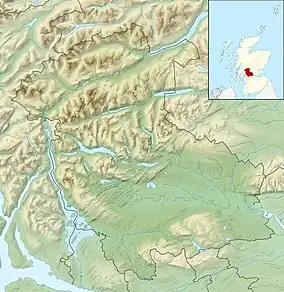
| Location | NN412285 |
| Coordinates | 56°25′19″N 4°34′29″W / 56.422°N 4.5748°W |
| Type | freshwater loch |
| Max. length | 0.804 km (0.500 mi)[1] |
| Max. width | 0.40 km (0.25 mi)[1] |
| Surface area | 11.7 ha (29 acres)[2] |
| Average depth | 7 ft (2.1 m)[1] |
| Max. depth | 18 ft (5.5 m)[1] |
| Water volume | 9,664,000 cu ft (273,700 m3)[1] |
| Shore length1 | 2 km (1.2 mi) [2] |
| Surface elevation | 441 m (1,447 ft)[2] |
| Max. temperature | 57.5 °F (14.2 °C) |
| Min. temperature | 48 °F (9 °C) |
| Islands | 0 |
| 1 Shore length is not a well-defined measure. | |
Loch Essan is a freshwater trout loch, located 2 miles north of Loch Dochart, within the Stirling Council Area, Scotland.[1][2]
Settlements
On the mid north coast of the loch is the remains of four Shieling hut with no roofs.[3] The huts would have been used as lodges for shepherds, summer livestock grazers, and much later, after the Highland Clearances, fly fisherman, before they fell into disrepair due to lack of maintenance. The loch now a bothy, a former 3 roomed shepherd's cottage.[4]
References
- 1 2 3 4 5 6 John, Murray; Lawrence, Pullar (1910). Bathymetrical Survey of the Fresh-Water Lochs of Scotland, 1897-1909 Lochs of the Tay Basin Volume II - Loch Essan. National Library of Scotland: National Challenger Officer. p. 90. Retrieved 14 September 2018.
 This article incorporates text from this source, which is in the public domain.
 - 1 2 3 4 "Loch Essan". Centre for Ecology and Hydrology. Scotland and Northern Ireland Forum for Environmental Research (SNIFFER. Retrieved 26 June 2020.
- ↑ "Loch Essan". Canmore. Historic Environment Scotland. Retrieved 15 September 2018.
- ↑ "Bothy: Essan". Mountain Bothy Association. Mountain Bothies Association 2018. Retrieved 15 September 2018.
This article is issued from Wikipedia. The text is licensed under Creative Commons - Attribution - Sharealike. Additional terms may apply for the media files.