| Loch Inver | |
|---|---|
 | |
 Loch Inver | |
| Location | grid reference NC 0707 2213 |
| Coordinates | 58°08′45″N 5°16′46″W / 58.14590073°N 5.27956005°W |
| Type | Sea Loch |
| Basin countries | Scotland, United Kingdom |
| Salinity | Seawater |
| Surface elevation | Sea Level |
| Frozen | No |
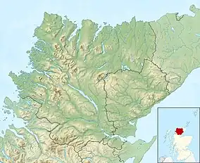
Loch Inver is a 3.62-kilometre-long (1+61⁄64-nautical-mile) sea loch in Assynt, Sutherland and is on the northwest coast of Scotland.[1] The loch meets the coastal embayment of Enard Bay at the north end and The Minch, where it meets Soyea Island at its mouth.[1]
Geography
At the head of the bay is Soyea Island.[2] It is small rocky uninhabited island whose radial axis lies on a horizontal line, the same as the bay, and is located 1+3⁄4 nmi (3 km) from Badnaban on a bearing of broadly east if slightly north and 2 nmi (4 km) south-southwest of Achmelvich.[3][2]
Gallery
 Navigation beacon far out on Loch Inver
 River Inver entering Loch Inver at dusk
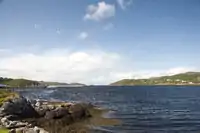
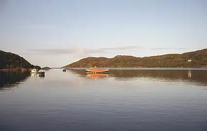 Loch inver from the west, the inner sea loch
References
- 1 2 Gittings, Bruce; Munro, David. "Loch Inver, Highland". The Gazetteer for Scotland. School of GeoSciences, University of Edinburgh and The Royal Scottish Geographical Society. Retrieved 19 October 2020.
- 1 2 Gittings, Bruce; Munro, David. "Soyea Island". The Gazetteer for Scotland. School of GeoSciences, University of Edinburgh and The Royal Scottish Geographical Society. Retrieved 29 April 2021.
- ↑ Great Britain. Hydrographic Dept (1911). West Coast of Scotland Pilot. p. 69. Retrieved 29 April 2021.
This article is issued from Wikipedia. The text is licensed under Creative Commons - Attribution - Sharealike. Additional terms may apply for the media files.