Luhuo County
炉霍县 · བྲག་འགོ་རྫོང་། Lu-ho, Zhaggo | |
|---|---|
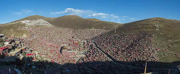
 Karsa Monastery | |
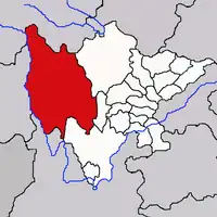
.png.webp) Location of Luhuo County (red) within Garzê Prefecture (yellow) and Sichuan | |
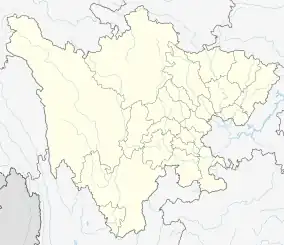
 Luhuo Location of the seat in Sichuan  Luhuo Luhuo (China) | |
| Coordinates: 31°27′N 100°42′E / 31.450°N 100.700°E | |
| Country | China |
| Province | Sichuan |
| Autonomous prefecture | Garzê |
| County seat | Xindo (Xindu) |
| Area | |
| • Total | 4,601 km2 (1,776 sq mi) |
| Population (2020)[1] | |
| • Total | 47,185 |
| • Density | 10/km2 (27/sq mi) |
| Time zone | UTC+8 (China Standard) |
| Website | www |
| Luhuo County | |||||||
|---|---|---|---|---|---|---|---|
| Chinese name | |||||||
| Simplified Chinese | 炉霍县 | ||||||
| Traditional Chinese | 爐霍縣 | ||||||
| |||||||
| Tibetan name | |||||||
| Tibetan | བྲག་འགོ་རྫོང་། | ||||||
| |||||||
Luhuo County or Zhaggo (Chinese: 炉霍县; Tibetan: བྲག་འགོ་རྫོང་།) is a county of Sichuan Province, China. It is under the administration of the Garzê Tibetan Autonomous Prefecture.
History
On March 24, 1923, a magnitude 7.3 earthquake struck between Luhuo and Dawu and killed 4800 people. [2]
On February 6, 1973, a magnitude 7.6 earthquake occurred near Zhaggo, a town in the county. [3]

Administrative divisions
Zhaggo County is divided into 4 towns and 11 townships:
| Name | Simplified Chinese | Hanyu Pinyin | Tibetan | Wylie | Administrative division code | |
|---|---|---|---|---|---|---|
| Towns | ||||||
| Xindo Town (Xindu) |
新都镇 | Xīndū Zhèn | ཤིས་མདོ་གྲོང་རྡལ། | shis mdo grong rdal | 513327100 | |
| Zhêhor Town (Zhuwo) |
朱倭镇 | Zhūwō Zhèn | ཏྲེ་ཧོར་གྲོང་རྡལ། | tre hor grong rdal | 513327101 | |
| Xaratang Town (Xialatuo) |
虾拉沱镇 | Xiālātuó Zhèn | ཤ་རྭ་ཐང་གྲོང་རྡལ། | sha rwa thang grong rdal | 513327103 | |
| Ligogdoima Town (Shangluokema) |
上罗柯马镇 | Shàngluókēmǎ Zhèn | ལི་ཀོག་སྟོད་མ་གྲོང་རྡལ། | li kog stod ma grong rdal | 513327104 | |
| Townships | ||||||
| Nyiba Township (Niba) |
泥巴乡 | Níbā Xiāng | སྙ་པ་ཤང་། | snya pa shang | 513327200 | |
| Yardê Township (Yade) |
雅德乡 | Yǎdé Xiāng | ཡར་སྡེ་ཤང་། | yar sde shang | 513327201 | |
| Norqung Township (Luoqiu) |
洛秋乡 | Luòqiū Xiāng | ནོར་ཆུང་ཤང་། | nor chung shang | 513327202 | |
| Xinda Township (Rinda, Renda) |
仁达乡 | Réndá Xiāng | གཞི་མདའ་ཤང་། | gzhi mda' shang | 513327205 | |
| Dando Township (Dandu) |
旦都乡 | Dàndū Xiāng | མདའ་མདོ་ཤང་། | mda' mdo shang | 513327207 | |
| Conggo Township (Chonggu) |
充古乡 | Chōnggǔ Xiāng | མཚོ་འགོ་ཤང་། | mtsho 'go shang | 513327208 | |
| Gêzê Township (Gengzhi) |
更知乡 | Gēngzhī Xiāng | དགེ་རྩེ་ཤང་། | dge rtse shang | 513327209 | |
| Karnya Township (Karnyag, Kaniang) |
卡娘乡 | Kǎniáng Xiāng | མཁར་གཉའ་ཤང་། | mkhar gnya' shang | 513327210 | |
| Zangdoi Township (Zongta) |
宗塔乡 | Zōngtǎ Xiāng | གཙང་སྟོད་ཤང་། | gtsang stod shang | 513327211 | |
| Zangmai Township (Zongmai) |
宗麦乡 | Zōngmài Xiāng | གཙང་སྨད་ཤང་། | gtsang smad shang | 513327212 | |
| Likogma Maima Township (Limai, Xialuokema) |
下罗柯马乡 | Xiàluókēmǎ Xiāng | ལི་ཁོག་མ་སྨད་མ་ཤང་། | li khog ma smad ma shang | 513327214 | |
Climate
| Climate data for Luhuo (1991–2019 normals, extremes 1981–2010) | |||||||||||||
|---|---|---|---|---|---|---|---|---|---|---|---|---|---|
| Month | Jan | Feb | Mar | Apr | May | Jun | Jul | Aug | Sep | Oct | Nov | Dec | Year |
| Record high °C (°F) | 22.1 (71.8) |
21.9 (71.4) |
27.3 (81.1) |
28.9 (84.0) |
30.3 (86.5) |
31.0 (87.8) |
31.2 (88.2) |
30.1 (86.2) |
27.9 (82.2) |
26.3 (79.3) |
23.2 (73.8) |
20.0 (68.0) |
31.2 (88.2) |
| Mean daily maximum °C (°F) | 8.6 (47.5) |
11.0 (51.8) |
13.7 (56.7) |
17.0 (62.6) |
20.1 (68.2) |
21.5 (70.7) |
22.6 (72.7) |
22.7 (72.9) |
20.4 (68.7) |
16.3 (61.3) |
12.5 (54.5) |
9.2 (48.6) |
16.3 (61.4) |
| Daily mean °C (°F) | −2.7 (27.1) |
0.6 (33.1) |
4.2 (39.6) |
7.8 (46.0) |
11.5 (52.7) |
13.9 (57.0) |
15.0 (59.0) |
14.6 (58.3) |
12.2 (54.0) |
7.4 (45.3) |
1.6 (34.9) |
−2.6 (27.3) |
7.0 (44.5) |
| Mean daily minimum °C (°F) | −10.8 (12.6) |
−7.3 (18.9) |
−3.1 (26.4) |
0.8 (33.4) |
4.9 (40.8) |
8.5 (47.3) |
9.8 (49.6) |
9.3 (48.7) |
7.1 (44.8) |
1.7 (35.1) |
−5.4 (22.3) |
−10.2 (13.6) |
0.4 (32.8) |
| Record low °C (°F) | −24.0 (−11.2) |
−19.3 (−2.7) |
−14.3 (6.3) |
−7.2 (19.0) |
−4.5 (23.9) |
0.0 (32.0) |
1.6 (34.9) |
0.5 (32.9) |
−1.9 (28.6) |
−9.3 (15.3) |
−15.0 (5.0) |
−21.7 (−7.1) |
−24.0 (−11.2) |
| Average precipitation mm (inches) | 4.0 (0.16) |
7.1 (0.28) |
19.8 (0.78) |
38.3 (1.51) |
78.0 (3.07) |
153.8 (6.06) |
140.2 (5.52) |
102.0 (4.02) |
108.6 (4.28) |
52.5 (2.07) |
7.2 (0.28) |
2.8 (0.11) |
714.3 (28.14) |
| Average precipitation days (≥ 0.1 mm) | 3.1 | 5.5 | 9.2 | 13.4 | 19.3 | 23.8 | 21.2 | 18.5 | 19.3 | 13.4 | 4.3 | 2.5 | 153.5 |
| Average snowy days | 4.9 | 7.7 | 10.7 | 5.8 | 0.7 | 0 | 0 | 0 | 0.1 | 2.5 | 5.2 | 3.9 | 41.5 |
| Average relative humidity (%) | 42 | 43 | 48 | 53 | 58 | 69 | 71 | 71 | 72 | 67 | 54 | 47 | 58 |
| Mean monthly sunshine hours | 208.0 | 185.3 | 214.1 | 214.9 | 216.7 | 185.9 | 188.0 | 188.9 | 177.9 | 183.9 | 203.9 | 218.2 | 2,385.7 |
| Percent possible sunshine | 65 | 59 | 57 | 55 | 51 | 44 | 44 | 46 | 49 | 53 | 65 | 70 | 55 |
| Source: China Meteorological Administration[4][5] | |||||||||||||
References
- ↑ "甘孜州第七次全国人口普查公报(第二号)" (in Chinese). Government of Garzê Prefecture. 2021-06-04.
- ↑ "Significant Earthquake Information", United States Geological Survey
- ↑ "Significant Earthquake Information", United States Geological Survey
- ↑ 中国气象数据网 – WeatherBk Data (in Simplified Chinese). China Meteorological Administration. Retrieved 13 April 2023.
- ↑ 中国气象数据网 (in Simplified Chinese). China Meteorological Administration. Retrieved 13 April 2023.
This article is issued from Wikipedia. The text is licensed under Creative Commons - Attribution - Sharealike. Additional terms may apply for the media files.

