Mühlenbecker Land | |
|---|---|
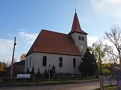 Church in Zühlsdorf quarter | |
 Coat of arms | |
Location of Mühlenbecker Land within Oberhavel district 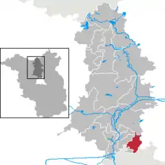 | |
 Mühlenbecker Land  Mühlenbecker Land | |
| Coordinates: 52°38′N 13°23′E / 52.633°N 13.383°E | |
| Country | Germany |
| State | Brandenburg |
| District | Oberhavel |
| Subdivisions | 4 districts |
| Government | |
| • Mayor (2019–27) | Filippo Smaldino[1] (SPD) |
| Area | |
| • Total | 52.35 km2 (20.21 sq mi) |
| Elevation | 50 m (160 ft) |
| Population (2021-12-31)[2] | |
| • Total | 15,513 |
| • Density | 300/km2 (770/sq mi) |
| Time zone | UTC+01:00 (CET) |
| • Summer (DST) | UTC+02:00 (CEST) |
| Postal codes | 16567 |
| Dialling codes | 033056 |
| Vehicle registration | OHV |
| Website | www.muehlenbeckerland.de |
Mühlenbecker Land is a municipality in the Oberhavel district, in Brandenburg, Germany.
History
The municipality shared its borders partly with the former West Berlin, and so during the period 1961-1990 it was separated from it by the Berlin Wall.
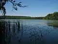 Lake "Mühlenbecker See"
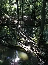
Demography
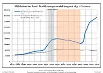 Development of population since 1875 within the current Boundaries (Blue Line: Population; Dotted Line: Comparison to Population development in Brandenburg state; Grey Background: Time of Nazi Germany; Red Background: Time of communist East Germany)
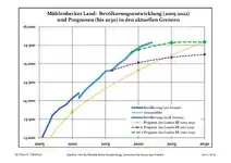 Recent Population Development and Projections (Population Development before Census 2011 (blue line); Recent Population Development according to the Census in Germany in 2011 (blue bordered line); Official projections for 2005-2030 (yellow line); for 2020-2030 (green line); for 2017-2030 (scarlet line)
|
|
|
References
- ↑ Landkreis Oberhavel Wahl der Bürgermeisterin / des Bürgermeisters, accessed 2 July 2021.
- ↑ "Bevölkerungsentwicklung und Flächen der kreisfreien Städte, Landkreise und Gemeinden im Land Brandenburg 2021" (PDF). Amt für Statistik Berlin-Brandenburg (in German). June 2022.
- ↑ Detailed data sources are to be found in the Wikimedia Commons.Population Projection Brandenburg at Wikimedia Commons
Towns and municipalities in Oberhavel | ||
|---|---|---|
Coat of Arms of Oberhavel district | ||
This article is issued from Wikipedia. The text is licensed under Creative Commons - Attribution - Sharealike. Additional terms may apply for the media files.