Majiang County
麻江县 Makiang | |
|---|---|
 | |
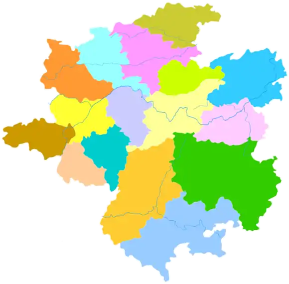 Majiang is the westernmost division in this map of Qiandongnan | |
.png.webp) Qiandongnan in Guizhou | |
| Coordinates (Majiang County government): 26°29′29″N 107°35′22″E / 26.4913°N 107.5894°E | |
| Country | People's Republic of China |
| Province | Guizhou |
| Autonomous prefecture | Qiandongnan |
| Area | |
| • Total | 1,222 km2 (472 sq mi) |
| Population (2010) | |
| • Total | 167,596 |
| • Density | 140/km2 (360/sq mi) |
| Time zone | UTC+8 (China Standard) |
Majiang County (Chinese: 麻江县; pinyin: Májiāng Xiàn) is a county of southeast-central Guizhou province, China. It is the westernmost county-level division of the Qiandongnan Miao and Dong Autonomous Prefecture.
Languages
Languages spoken in Majiang County include Dongjia, Raojia, and Mulao. The Yao of Heba (河坝) speak an Raojia.
Demographics
Ethnic Mulao are located in the following villages.[1] They are called "Ka" (卡) by the Raojia and "Kabie" (卡别) by the Miao.
- Jidong Township (基东乡): Wengpao (瓮袍), Wengchang (瓮偿), An'e (安鹅), Jidong (基东)
- Xiasi Township (下司镇): Wenggang (瓮港), Dapo (大坡)
- Longshan Township (龙山乡): Fuxing (复兴)
- Bibo Township (碧波乡): Xinpai (新牌)
The Raojia (also called Tianjia 天家 or Tian Miao 天苗) live in the townships of Heba (河坝) and Longshan (龙山) (in 23 natural villages, inside 6 administrative villages).[1] The Dongjia are distributed in 250 natural villages, inside 35 administrative villages and 12 townships.[1]
Climate
| Climate data for Majiang (1991–2020 normals, extremes 1981–2010) | |||||||||||||
|---|---|---|---|---|---|---|---|---|---|---|---|---|---|
| Month | Jan | Feb | Mar | Apr | May | Jun | Jul | Aug | Sep | Oct | Nov | Dec | Year |
| Record high °C (°F) | 21.8 (71.2) |
28.9 (84.0) |
31.3 (88.3) |
33.2 (91.8) |
33.2 (91.8) |
32.4 (90.3) |
34.1 (93.4) |
34.5 (94.1) |
33.3 (91.9) |
30.5 (86.9) |
27.4 (81.3) |
23.8 (74.8) |
34.5 (94.1) |
| Mean daily maximum °C (°F) | 6.7 (44.1) |
10.1 (50.2) |
14.4 (57.9) |
20.1 (68.2) |
23.5 (74.3) |
25.6 (78.1) |
27.8 (82.0) |
28.1 (82.6) |
25.0 (77.0) |
19.6 (67.3) |
15.3 (59.5) |
9.6 (49.3) |
18.8 (65.9) |
| Daily mean °C (°F) | 3.8 (38.8) |
6.4 (43.5) |
10.2 (50.4) |
15.5 (59.9) |
19.3 (66.7) |
21.9 (71.4) |
23.8 (74.8) |
23.5 (74.3) |
20.5 (68.9) |
15.7 (60.3) |
11.3 (52.3) |
6.0 (42.8) |
14.8 (58.7) |
| Mean daily minimum °C (°F) | 1.8 (35.2) |
4.0 (39.2) |
7.5 (45.5) |
12.5 (54.5) |
16.2 (61.2) |
19.3 (66.7) |
21.0 (69.8) |
20.4 (68.7) |
17.3 (63.1) |
13.1 (55.6) |
8.5 (47.3) |
3.6 (38.5) |
12.1 (53.8) |
| Record low °C (°F) | −6.9 (19.6) |
−6.2 (20.8) |
−4.2 (24.4) |
1.6 (34.9) |
6.4 (43.5) |
11.4 (52.5) |
13.0 (55.4) |
13.9 (57.0) |
9.4 (48.9) |
3.0 (37.4) |
−4.3 (24.3) |
−6.6 (20.1) |
−6.9 (19.6) |
| Average precipitation mm (inches) | 43.9 (1.73) |
40.0 (1.57) |
73.7 (2.90) |
105.4 (4.15) |
199.4 (7.85) |
266.0 (10.47) |
222.3 (8.75) |
114.6 (4.51) |
122.1 (4.81) |
99.6 (3.92) |
60.1 (2.37) |
34.4 (1.35) |
1,381.5 (54.38) |
| Average precipitation days (≥ 0.1 mm) | 17.9 | 15.6 | 18.7 | 18.6 | 18.7 | 18.7 | 16.4 | 14.3 | 12.6 | 15.4 | 12.7 | 13.4 | 193 |
| Average snowy days | 5.4 | 2.6 | 0.7 | 0.1 | 0 | 0 | 0 | 0 | 0 | 0 | 0.1 | 1.8 | 10.7 |
| Average relative humidity (%) | 85 | 83 | 84 | 82 | 83 | 85 | 83 | 81 | 81 | 84 | 82 | 81 | 83 |
| Mean monthly sunshine hours | 32.3 | 46.5 | 64.3 | 88.7 | 102.5 | 83.5 | 147.0 | 161.4 | 119.1 | 83.0 | 80.0 | 57.7 | 1,066 |
| Percent possible sunshine | 10 | 15 | 17 | 23 | 25 | 20 | 35 | 40 | 33 | 23 | 25 | 18 | 24 |
| Source: China Meteorological Administration[2][3] | |||||||||||||
References
- 1 2 3 Majiang County Gazetteer (1992)
- ↑ 中国气象数据网 – WeatherBk Data (in Simplified Chinese). China Meteorological Administration. Retrieved 28 April 2023.
- ↑ 中国气象数据网 (in Simplified Chinese). China Meteorological Administration. Retrieved 28 April 2023.
This article is issued from Wikipedia. The text is licensed under Creative Commons - Attribution - Sharealike. Additional terms may apply for the media files.