Wangmo County
望谟县 | |
|---|---|
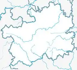
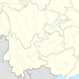
 Wangmo Location of the seat in Guizhou  Wangmo Wangmo (Southwest China) | |
| Coordinates (Wangmo County government): 25°10′29″N 106°05′41″E / 25.1746°N 106.0946°E | |
| Country | People's Republic of China |
| Province | Guizhou |
| Autonomous prefecture | Qianxinan |
| Area | |
| • Total | 3,005.5 km2 (1,160.4 sq mi) |
| Population (2010) | |
| • Total | 251,629 |
| • Density | 84/km2 (220/sq mi) |
| Time zone | UTC+8 (China Standard) |
Wangmo County (simplified Chinese: 望谟县; traditional Chinese: 望謨縣; pinyin: Wàngmó Xiàn) is a county in the southwest of Guizhou province, China, bordering Guangxi to the southeast. It is under the administration of the Qianxinan Buyei and Miao Autonomous Prefecture.
Climate
Wangmo recorded 122.5 millimetres (4.82 inches) of rainfall in one hour, on 9 June 2011, the most rainfall in the county in 200 years.[1] And on 20 June 2011, 312 mm (12.28 in) of rain fell in 3hrs in the county [2] as part of significant flooding across the region.
| Climate data for Wangmo (1991–2020 normals, extremes 1981–2010) | |||||||||||||
|---|---|---|---|---|---|---|---|---|---|---|---|---|---|
| Month | Jan | Feb | Mar | Apr | May | Jun | Jul | Aug | Sep | Oct | Nov | Dec | Year |
| Record high °C (°F) | 30.5 (86.9) |
34.4 (93.9) |
36.2 (97.2) |
38.8 (101.8) |
38.5 (101.3) |
37.3 (99.1) |
36.9 (98.4) |
37.2 (99.0) |
37.3 (99.1) |
34.4 (93.9) |
31.9 (89.4) |
30.2 (86.4) |
38.8 (101.8) |
| Mean daily maximum °C (°F) | 15.2 (59.4) |
18.6 (65.5) |
22.8 (73.0) |
27.7 (81.9) |
29.8 (85.6) |
30.9 (87.6) |
31.8 (89.2) |
31.9 (89.4) |
30.0 (86.0) |
25.5 (77.9) |
22.1 (71.8) |
17.0 (62.6) |
25.3 (77.5) |
| Daily mean °C (°F) | 10.6 (51.1) |
13.2 (55.8) |
17.0 (62.6) |
21.6 (70.9) |
24.3 (75.7) |
25.9 (78.6) |
26.6 (79.9) |
26.2 (79.2) |
24.1 (75.4) |
20.4 (68.7) |
16.4 (61.5) |
12.0 (53.6) |
19.9 (67.8) |
| Mean daily minimum °C (°F) | 7.8 (46.0) |
9.7 (49.5) |
13.3 (55.9) |
17.4 (63.3) |
20.1 (68.2) |
22.4 (72.3) |
23.2 (73.8) |
22.6 (72.7) |
20.5 (68.9) |
17.3 (63.1) |
13.0 (55.4) |
8.9 (48.0) |
16.4 (61.4) |
| Record low °C (°F) | −2.0 (28.4) |
0.6 (33.1) |
0.6 (33.1) |
6.5 (43.7) |
10.3 (50.5) |
12.4 (54.3) |
15.4 (59.7) |
16.8 (62.2) |
11.0 (51.8) |
7.2 (45.0) |
1.6 (34.9) |
−2.5 (27.5) |
−2.5 (27.5) |
| Average precipitation mm (inches) | 26.3 (1.04) |
19.9 (0.78) |
37.8 (1.49) |
66.5 (2.62) |
185.8 (7.31) |
284.7 (11.21) |
215.7 (8.49) |
175.4 (6.91) |
93.9 (3.70) |
79.7 (3.14) |
40.7 (1.60) |
19.0 (0.75) |
1,245.4 (49.04) |
| Average precipitation days (≥ 0.1 mm) | 10.9 | 8.3 | 10.1 | 11.6 | 14.1 | 16.2 | 16.1 | 14.9 | 9.8 | 11.8 | 7.8 | 7.7 | 139.3 |
| Average snowy days | 0.6 | 0.2 | 0 | 0 | 0 | 0 | 0 | 0 | 0 | 0 | 0 | 0.1 | 0.9 |
| Average relative humidity (%) | 78 | 73 | 70 | 70 | 73 | 80 | 80 | 81 | 79 | 81 | 79 | 77 | 77 |
| Mean monthly sunshine hours | 56.0 | 76.6 | 98.9 | 137.3 | 150.2 | 131.3 | 165.8 | 179.6 | 148.4 | 99.8 | 106.0 | 75.4 | 1,425.3 |
| Percent possible sunshine | 17 | 24 | 26 | 36 | 36 | 32 | 40 | 45 | 41 | 28 | 33 | 23 | 32 |
| Source: China Meteorological Administration[3][4] | |||||||||||||
External links
- ↑ "China floods kill fifty-two as 100,000 flee homes". Associated Foreign Press. 9 June 2011. Archived from the original on 11 June 2011. Retrieved 10 June 2011.
- ↑ "Flood-hit China braces for more storms". 20 June 2011.
- ↑ 中国气象数据网 – WeatherBk Data (in Simplified Chinese). China Meteorological Administration. Retrieved 28 April 2023.
- ↑ 中国气象数据网 (in Simplified Chinese). China Meteorological Administration. Retrieved 28 April 2023.
This article is issued from Wikipedia. The text is licensed under Creative Commons - Attribution - Sharealike. Additional terms may apply for the media files.