| Manimuktha River | |
|---|---|
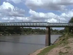 A bridge over the Manimuktha River at Veerasolapuram. | |
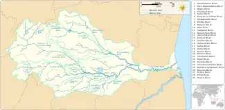 The Vellar River river system, including the Manimuktha River | |
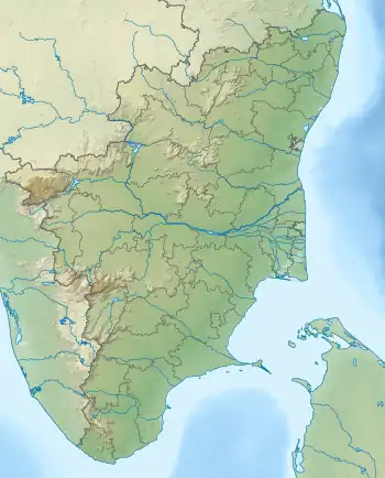 Location of the river mouth in Tamil Nadu  Manimuktha River (India) | |
| Location | |
| Country | |
| State | Tamil Nadu |
| Districts | Kallakurichi, Cuddalore |
| Taluks | Sankarapuram, Kallakkurichi, Vriddachalam |
| Physical characteristics | |
| Source | Confluence of Mani River and Muktha River |
| • location | Sankarapuram taluk, Kallakurichi district |
| • coordinates | 11°49′21″N 78°58′01″E / 11.82250°N 78.96694°E |
| • elevation | 125 m (410 ft)[1] |
| Mouth | Confluence with Vellar River |
• location | Vriddachalam taluk, Cuddalore district |
• coordinates | 11°25′01″N 79°27′50″E / 11.41694°N 79.46389°E[1] |
• elevation | 20 m (66 ft) |
| Basin features | |
| Progression | Vellar River→ Bay of Bengal |
| River system | Vellar River drainage basin |
| Tributaries | |
| • right | Gomukhi River, Periya River |
The Manimuktha River is a river in the Kallakurichi and Cuddalore districts of the Indian state of Tamil Nadu.[2][3]
References
- 1 2 "Elevation Map". www.elevationmap.net. Retrieved 16 March 2021.
- ↑ "Cuddalore District Census Handbook" (PDF). censusindia.gov.in. 2011. Retrieved 14 March 2021.
- ↑ "Viluppuram District Census Handbook" (PDF). censusindia.gov.in. 2011. Retrieved 15 February 2021.
See also
This article is issued from Wikipedia. The text is licensed under Creative Commons - Attribution - Sharealike. Additional terms may apply for the media files.