Milanville, Pennsylvania | |
|---|---|
| Village of Milanville | |
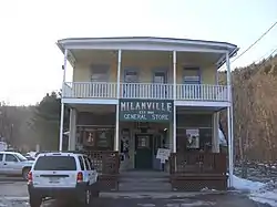 The Milanville General Store in Milanville. | |
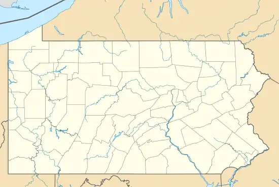 Milanville, Pennsylvania Location within Pennsylvania.  Milanville, Pennsylvania Milanville, Pennsylvania (the United States) | |
| Coordinates: 41°40′17″N 75°03′55″W / 41.67139°N 75.06528°W | |
| Country | United States |
| State | Pennsylvania |
| U.S. Congressional District | PA-10 |
| School District | Wayne Highlands Region I |
| County | Wayne |
| Magisterial District | 22-3-04[1] |
| Township | Damascus |
| Named for | Milan, Italy |
| Elevation | 755[2] ft (230 m) |
| Time zone | UTC-5 (Eastern (EST)) |
| • Summer (DST) | UTC-4 (Eastern Daylight (EDT)) |
| ZIP code | 18443[3] |
| Area code | 570 |
| GNIS feature ID | 1181094[2] |
| FIPS code | 42-127-18104[4]-49328[2] |
| Waterways | Calkins Creek[5] (North[6] and South[7] Branches) |
Milanville is a village in Damascus Township, Wayne County, Pennsylvania, United States.
Geography
Milanville is located along the Delaware River and the New York border north of Narrowsburg, New York.
References
- ↑ "District Magistrate". Wayne County, PA. Wayne County Courthouse. 2014. Archived from the original on November 27, 2014. Retrieved December 4, 2014.
- 1 2 3 "Milanville". Geographic Names Information System. United States Geological Survey, United States Department of the Interior. August 2, 1979. Retrieved December 4, 2014.
- ↑ "Look up a ZIP Code". USPS.COM. USPS. 2014. Retrieved December 5, 2014.
- ↑
U.S. Census Bureau. Census 2000. "Census Demographic Profiles, Damascus Township" (PDF). CenStats Databases. Retrieved January 31, 2009.
{{cite web}}: CS1 maint: numeric names: authors list (link) - ↑ "Calkins Creek". Geographic Names Information System. United States Geological Survey, United States Department of the Interior. August 2, 1979. Retrieved December 5, 2014.
- ↑ "North Branch Calkins Creek". Geographic Names Information System. United States Geological Survey, United States Department of the Interior. August 2, 1979. Retrieved December 5, 2014.
- ↑ "South Branch Calkins Creek". Geographic Names Information System. United States Geological Survey, United States Department of the Interior. August 2, 1979. Retrieved December 5, 2014.
Municipalities and communities of Wayne County, Pennsylvania, United States | ||
|---|---|---|
| Boroughs | 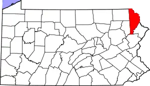 | |
| Townships | ||
| CDPs | ||
| Other communities | ||
| Footnotes | ‡This populated place also has portions in an adjacent county or counties | |
This article is issued from Wikipedia. The text is licensed under Creative Commons - Attribution - Sharealike. Additional terms may apply for the media files.