Miller | |
|---|---|
Neighbourhood | |
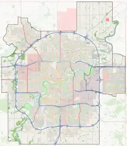
 Miller Location of Miller in Edmonton | |
| Coordinates: 53°36′47″N 113°24′47″W / 53.613°N 113.413°W | |
| Country | |
| Province | |
| City | Edmonton |
| Quadrant[1] | NW |
| Ward[1] | Dene |
| Sector[2] | Northeast |
| Area[3][4] | Casselman-Steele Heights |
| Government | |
| • Administrative body | Edmonton City Council |
| • Councillor | Aaron Paquette |
| Area | |
| • Total | 0.83 km2 (0.32 sq mi) |
| Elevation | 675 m (2,215 ft) |
| Population (2012)[7] | |
| • Total | 3,122 |
| • Density | 3,761.4/km2 (9,742/sq mi) |
| • Change (2009–12) | |
| • Dwellings | 1,148 |
Miller is a residential neighbourhood located in northeast Edmonton, Alberta, Canada. It is bounded by 153 Avenue to the north, 50 Street to the west, and Manning Drive to the southeast.
Demographics
In the City of Edmonton's 2012 municipal census, Miller had a population of 3,122 living in 1,148 dwellings,[7] a 9.9% change from its 2009 population of 2,841.[8] With a land area of 0.83 km2 (0.32 sq mi),[6] it had a population density of 3,761.4 people/km2 in 2012.[6][7]
Residential development
According to the 2001 federal census, substantially all residential development in Miller occurred after 1996.[9]
Almost two out of every three residences (64%) are single-family dwellings according to the 2005 municipal census. One in five (19%) are duplexes.[10] One in seven (14%) are rented apartments in low-rise buildings with fewer than five stories. The remaining four percent are row houses. Seventeen out of every twenty residences (86%) are owner-occupied.[11]
Transportation and services
The Edmonton Police Service's North Division headquarters is located at 142 Avenue and 50 Street near the south end of the neighbourhood.
The Clareview LRT station is located just to the south east of the neighbourhood. The LRT provides service to Northlands, the Coliseum, Commonwealth Stadium, the downtown core, and the University of Alberta.
Surrounding neighbourhoods
References
- 1 2 "City of Edmonton Wards & Standard Neighbourhoods" (PDF). City of Edmonton. Archived from the original (PDF) on December 16, 2011. Retrieved February 13, 2013.
- ↑ "Edmonton Developing and Planned Neighbourhoods, 2011" (PDF). City of Edmonton. Archived from the original (PDF) on March 26, 2014. Retrieved February 13, 2013.
- ↑ "The Way We Grow: Municipal Development Plan Bylaw 15100" (PDF). City of Edmonton. 2010-05-26. Archived from the original (PDF) on May 2, 2015. Retrieved February 13, 2013.
- ↑ "City of Edmonton Plans in Effect" (PDF). City of Edmonton. November 2011. Archived from the original (PDF) on October 17, 2013. Retrieved February 13, 2013.
- ↑ "City Councillors". City of Edmonton. Retrieved February 13, 2013.
- 1 2 3 "Neighbourhoods (data plus kml file)". City of Edmonton. Retrieved February 22, 2013.
- 1 2 3 "Municipal Census Results – Edmonton 2012 Census". City of Edmonton. Retrieved February 22, 2013.
- ↑ "2009 Municipal Census Results". City of Edmonton. Retrieved February 22, 2013.
- ↑ http://censusdocs.edmonton.ca/DD23/FEDERAL%202001/Neighbourhood/MILLER.pdf
- ↑ Duplexes include triplexes and quadruplexes.
- ↑ http://censusdocs.edmonton.ca/C05002/MUNICIPAL%202005/Neighbourhood/MILLER.pdf