Mořkov | |
|---|---|
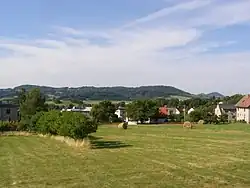 View of Mořkov | |
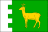 Flag 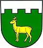 Coat of arms | |
 Mořkov Location in the Czech Republic | |
| Coordinates: 49°32′13″N 18°3′35″E / 49.53694°N 18.05972°E | |
| Country | |
| Region | Moravian-Silesian |
| District | Nový Jičín |
| First mentioned | 1411 |
| Area | |
| • Total | 10.72 km2 (4.14 sq mi) |
| Elevation | 360 m (1,180 ft) |
| Population (2023-01-01)[1] | |
| • Total | 2,432 |
| • Density | 230/km2 (590/sq mi) |
| Time zone | UTC+1 (CET) |
| • Summer (DST) | UTC+2 (CEST) |
| Postal code | 742 72 |
| Website | www |
Mořkov (German: Murk) is a municipality and village in Nový Jičín District in the Moravian-Silesian Region of the Czech Republic. It has about 2,400 inhabitants.
Geography
The northern part of the municipality lies in the Moravian-Silesian Foothills, the southern part lies in the Moravian-Silesian Beskids. The highest point of the municipality is on the hill Hodorf at 765 metres (2,510 ft) above sea level.
History
The first written mention of Mořkov is from 1411.[2]
Transport
Mořkov is located on the railway line from Valašské Meziříčí to Frýdlant nad Ostravicí.
References
- ↑ "Population of Municipalities – 1 January 2023". Czech Statistical Office. 2023-05-23.
- ↑ "Zajímavosti a historie" (in Czech). Obec Mořkov. Retrieved 2022-02-22.
External links
Wikimedia Commons has media related to Mořkov.
This article is issued from Wikipedia. The text is licensed under Creative Commons - Attribution - Sharealike. Additional terms may apply for the media files.