Moen | |
|---|---|
Village | |
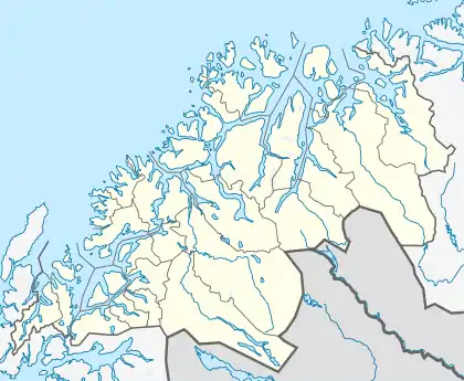
 Moen Location of the village  Moen Moen (Norway) | |
| Coordinates: 69°07′49″N 18°36′44″E / 69.13028°N 18.61222°E | |
| Country | Norway |
| Region | Northern Norway |
| County | Troms |
| District | Midt-Troms |
| Municipality | Målselv Municipality |
| Area | |
| • Total | 0.89 km2 (0.34 sq mi) |
| Elevation | 11 m (36 ft) |
| Population (2017)[1] | |
| • Total | 847 |
| • Density | 952/km2 (2,470/sq mi) |
| Time zone | UTC+01:00 (CET) |
| • Summer (DST) | UTC+02:00 (CEST) |
| Post Code | 9321 Moen |
Moen is the administrative centre of Målselv Municipality in Troms county, Norway. The village of Moen is located in the Målselvdalen valley about 10 km (6.2 mi) north of the village of Andselv and Bardufoss Airport. The 0.89-square-kilometre (220-acre) village has a population (2017) of 847 which gives the village a population density of 952 inhabitants per square kilometre (2,470/sq mi).[1]
The village lies along the Målselva river and the European route E6 crosses through the village with the Olsborg area in the north and the Moen area in the south. Most of the shops and schools are located in Olsborg, while the municipal offices are located in Moen. Målselv Church is located about 5 kilometres (3.1 mi) north of the village.
References
- 1 2 3 Statistisk sentralbyrå (1 January 2017). "Urban settlements. Population and area, by municipality".
- ↑ "Moen" (in Norwegian). yr.no. Retrieved 2012-10-09.
This article is issued from Wikipedia. The text is licensed under Creative Commons - Attribution - Sharealike. Additional terms may apply for the media files.