Montauroux
| |
|---|---|
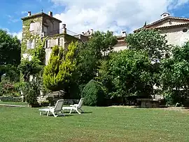 The Château de la Colle-Noire, in Montauroux | |
.svg.png.webp) Coat of arms | |
Location of Montauroux | |
 Montauroux 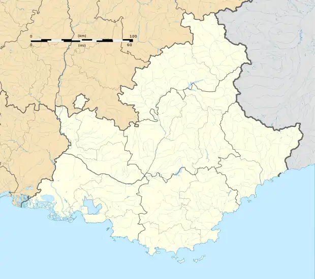 Montauroux | |
| Coordinates: 43°37′09″N 6°45′57″E / 43.6192°N 6.7658°E | |
| Country | France |
| Region | Provence-Alpes-Côte d'Azur |
| Department | Var |
| Arrondissement | Draguignan |
| Canton | Roquebrune-sur-Argens |
| Intercommunality | Pays de Fayence |
| Government | |
| • Mayor (2020–2026) | Jean-Yves Huet[1] |
| Area 1 | 33.41 km2 (12.90 sq mi) |
| Population | 6,685 |
| • Density | 200/km2 (520/sq mi) |
| Time zone | UTC+01:00 (CET) |
| • Summer (DST) | UTC+02:00 (CEST) |
| INSEE/Postal code | 83081 /83440 |
| Elevation | 150–400 m (490–1,310 ft) |
| 1 French Land Register data, which excludes lakes, ponds, glaciers > 1 km2 (0.386 sq mi or 247 acres) and river estuaries. | |
Montauroux (French pronunciation: [mɔ̃toʁu]; Occitan: Montauron) is a commune in the Var department in the Provence-Alpes-Côte d'Azur region in Southeastern France.
Its neighbour town is the smaller, picturesque Callian, which can be seen across a small valley. In 2019, Montauroux had a population of 6,548.
Geography

Montauroux is situated in the east of the Var and at the border of the Alpes-Maritimes. Montauroux rises in tiers of altitudes from 150 m to 400 m. The village has a southern exposure, facing the Esterel massif and the St Cassien Lake. Montauroux is located midway between the sea which is 30 km (19 mi) away and the first ski resort which is 40 km (25 mi), away. Montauroux benefits from an exceptional amount of sunny days and is visited by tourists in the summer months, many hotels are often fully booked for the summer by mid-April or earlier.
It is also part of the Pays de Fayence, a communauté de communes.
Demographics
| Year | Pop. | ±% p.a. |
|---|---|---|
| 1968 | 1,053 | — |
| 1975 | 1,375 | +3.89% |
| 1982 | 1,997 | +5.48% |
| 1990 | 2,773 | +4.19% |
| 1999 | 4,017 | +4.20% |
| 2007 | 5,048 | +2.90% |
| 2012 | 6,019 | +3.58% |
| 2017 | 6,411 | +1.27% |
| Source: INSEE[3] | ||
See also
References
- ↑ "Répertoire national des élus: les maires". data.gouv.fr, Plateforme ouverte des données publiques françaises (in French). 2 December 2020.
- ↑ "Populations légales 2021". The National Institute of Statistics and Economic Studies. 28 December 2023.
- ↑ Population en historique depuis 1968, INSEE