Montcalm | |
|---|---|
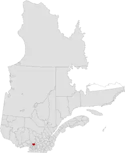 | |
| Coordinates: 45°54′N 73°40′W / 45.900°N 73.667°W[1] | |
| Country | |
| Province | |
| Region | Lanaudière |
| Effective | January 1, 1982 |
| County seat | Sainte-Julienne |
| Government | |
| • Type | Prefecture |
| • Prefect | Patrick Massé |
| Area | |
| • Total | 716.30 km2 (276.56 sq mi) |
| • Land | 709.58 km2 (273.97 sq mi) |
| Population (2021)[3] | |
| • Total | 58,680 |
| • Density | 82.7/km2 (214/sq mi) |
| • Change 2016–2021 | |
| • Dwellings | 25,557 |
| Time zone | UTC−5 (EST) |
| • Summer (DST) | UTC−4 (EDT) |
| Area code(s) | 450 and 579 |
| Website | www |
Montcalm is a regional county municipality in the Lanaudière region of Quebec, Canada. Its seat is Sainte-Julienne.
The population according to the 2021 Canadian Census was 58,680[3]
Subdivisions
There are 10 subdivisions within the RCM:[2]
|
|
Transportation
Access Routes
Highways and numbered routes that run through the municipality, including external routes that start or finish at the county border:[4]
See also
References
- ↑ "Banque de noms de lieux du Québec: Reference number 141051". toponymie.gouv.qc.ca (in French). Commission de toponymie du Québec.
- 1 2 3 "Répertoire des municipalités: Geographic code 630". www.mamh.gouv.qc.ca (in French). Ministère des Affaires municipales et de l'Habitation.
- 1 2 3 "Census Profile, 2021 Census: Montcalm, Municipalité régionale de comté [Census division], Quebec". Statistics Canada. Retrieved September 8, 2021.
- ↑ Official Transport Quebec Road Map
External links
Adjacent Counties & Equivalent Territories | |
|---|---|
| Regional county municipalities and equivalent territories | |
|---|---|
| Municipalities | |
This article is issued from Wikipedia. The text is licensed under Creative Commons - Attribution - Sharealike. Additional terms may apply for the media files.