| Muir of Allangrange | |
|---|---|
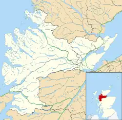
 Muir of Allangrange Location within the Ross and Cromarty area | |
| OS grid reference | NH559521 |
| Council area | |
| Country | Scotland |
| Sovereign state | United Kingdom |
| Post town | Muir of Ord |
| Postcode district | IV6 7 |
| Police | Scotland |
| Fire | Scottish |
| Ambulance | Scottish |
Muir of Allangrange is a scattered crofting township, lying 3 miles northeast of Muir of Ord on the western side of the Black Isle, in Ross-shire, Scottish Highlands[1] and is in the Scottish council area of Highland.[2]
References
- ↑ Microsoft; Nokia (26 February 2017). "Muir of Allangrange" (Map). Bing Maps. Microsoft. Retrieved 26 February 2017.
- ↑ Gittings, Bruce; Munro, David. "Muir of Allangrange, Highland". The Gazetteer for Scotland. School of GeoSciences, University of Edinburgh and The Royal Scottish Geographical Society. Retrieved 10 January 2020.
This article is issued from Wikipedia. The text is licensed under Creative Commons - Attribution - Sharealike. Additional terms may apply for the media files.