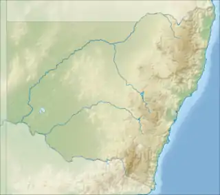
| Nattai National Park New South Wales | |
|---|---|
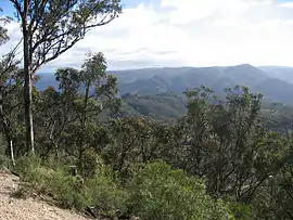 Nattai National Park, from Wollondilly lookout. | |
 Nattai National Park | |
| Nearest town or city | Oakdale |
| Coordinates | 34°17′22″S 150°21′37″E / 34.28944°S 150.36028°E |
| Established | 13 December 1991[1] |
| Area | 489.84 km2 (189.1 sq mi)[1] |
| Visitation | 1,000 (in 1997) |
| Managing authorities | NSW National Parks and Wildlife Service |
| Website | Nattai National Park |
| See also | Protected areas of New South Wales |
The Nattai National Park is a protected national park that is located in the Macarthur and Southern Highlands regions of New South Wales, in Australia. 48,984-hectare (121,040-acre) It is situated approximately 150 kilometres (93 mi) southwest of the Sydney central business district and primarily encompasses the valley of the Nattai River, which is surrounded by large sandstone cliffs. Part of the Southern Highlands Shale Forest and Woodland, the park is covered in dry sclerophyll (hard leafed) forest – mostly eucalypt and has fairly frequent forest fires. It is a largely untouched wilderness area, as it has no facilities[2] and despite it's closeness to Sydney, receives few visitors.
The Nattai National Park is one of the eight protected areas that, in 2000, was inscribed to form part of the UNESCO World Heritage-listed Greater Blue Mountains Area.[3] The Nattai National Park is the most southern of the eight protected areas within the World Heritage Site. The national park forms part of the Great Dividing Range.
The national park is bounded to the north by the Nattai State Conservation Area, the Burragorang State Conservation Area, and Lake Burragorang, inclusive of a 3-kilometre (1.9 mi) exclusion zone surrounding the lake; to the east by the Bargo State Conservation Area and the now partly disused Picton – Mittagong loop railway line; to the south by the Wombeyan Caves Road; to the southwest by the Kanangra-Boyd National Park; and to the west by the Yerranderie State Conservation Area. The Blue Mountains National Park does not directly adjoin the Nattai National Park, located on the northwestern shore of Lake Burragorang.[4]
The Nattai National Park contains much of the course and catchment of the Little, Nattai, Allum and Wollondilly rivers.[4]
History
The area now known as Nattai National Park has had a limited impact from Europeans. Several early expeditions attempting to cross the Blue Mountains passed through the area at the end of the 18th century, and settlers settled in the lower Nattai and Burragorang Valleys in 1827.[5] Early conservationists Myles Dunphy and Herb Gallop went on bushwalks in the region from 1912 onwards. An area held in high regard was a forest of Sydney blue gum around Blue Gum Creek. Dunphy lobbied for the stand to be preserved upon becoming aware of plans to log the area but was unsuccessful and the area was logged in the 1920s and 30s. Dunphy put forward a plan for a Greater Blue Mountains National Park, which incorporated what is now Nattai National Park in the southeast in 1932. The creation of Warragamba Dam in 1960 limited access for development of land upstream, but it was not until 1991 when plans for permanent protection and national park status looked to become realised.[5]
Access
The national park may be accessed via Wattle Ridge Fire Road, northeast of the small town of Hill Top. Unsealed road access to a small unsealed car park at the edge of the park. There are no facilities, except for an information board, and a logbook. Visitors have to sign in and out of the logbook when entering the park.
Alternate access is via the Wombeyan Caves Road.
Activities
Bushwalking
Nattai National Park has several bushwalk trails. Backpack camping is allowed, with a remote campground by the Nattai River known as Emitts Flat at the end of the Starlights Trail.
The difficulties on park's trails include: limited mobile reception,[6] all trails requiring bushwalking experience[7][8] and encounters with wildlife, such as snakes or wombats, being common.
Trails
- The Starlights Trail
- Nattai Road Park Entrance to Emmetts Flat on the Nattai River, It is 6.5 kilometres (4.0 mi) one way with 550 metres (1,800 ft) descent, approx. It begins at an elevation of roughly 640 metres (2,100 ft) and descends to 93 metres (305 ft) which is the altitude of the river. These are aggregate measurements based on topographical maps and GPS.
- Russells Needle
- An extension of Starlights Trail from Emmetts Flat south along the Nattai River to a tall rock spire.
- Katoomba to Mittagong Trail
- A long-distance trail starting in the Greater Blue Mountains World Heritage Area – 132 kilometres (82 mi) in length.
- Couridjah Corridor walk
- A 14 kilometres (8.7 mi) trail with gentle hills, nearby to lakes and rivers.
Climbing
See also
References
- 1 2 "Nattai National Park: Park management". Office of Environment and Heritage. Government of New South Wales. Retrieved 4 October 2014.
- ↑ https://www.nationalparks.nsw.gov.au/visit-a-park/parks/nattai-national-park/visitor-info#Facilities
- ↑ "Greater Blue Mountains Area". World Heritage List. UNESCO. 2014. Retrieved 31 August 2014.
- 1 2 "Nattai National Park". Office of Environment & Heritage. Government of New South Wales. Retrieved 4 October 2014.
- 1 2 Wright, Peter (1996). National Parks of Southern NSW. Rosebery, NSW: Bridge Printery. pp. 30–31. ISBN 0-9587590-1-4.
- ↑ https://www.nationalparks.nsw.gov.au/visit-a-park/parks/nattai-national-park/visitor-info#Safety-messages
- ↑ https://www.nationalparks.nsw.gov.au/things-to-do/walking-tracks/starlights-trail/visitor-info#track-difficulty
- ↑ https://www.nationalparks.nsw.gov.au/things-to-do/walking-tracks/couridjah-corridor-walk/visitor-info#track-difficulty
External links
- Free online topographic maps of Nattai – NSW Dept of Lands Spatial Portal
- Track notes with topographical map for Russells Needle via Slott Way Track and Starlight Track