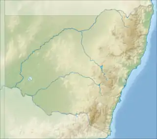
| Mount Boyce | |
|---|---|
 Mount Boyce The location of Mount Boyce in New South Wales | |
| Highest point | |
| Elevation | 1,093 m (3,586 ft)[1] |
| Coordinates | 33°37′10″S 150°16′28″E / 33.61948°S 150.274429°E |
| Geography | |
| Location | Blue Mountains region in New South Wales, Australia |
| Parent range | Blue Mountains |
| Climbing | |
| Easiest route | Great Western Highway |
Mount Boyce is a hill standing approximately 1,093 metres (3,586 ft) AMSL, situated as one of the highest points on a plateau within the Explorer Range, part of the Blue Mountains Range which is a spur off the Great Dividing Range. Mount Boyce is located 2 kilometres (1.2 mi) north of Blackheath, in New South Wales, Australia.[1]
Location and features
Mount Boyce is situated close to the point where the Great Western Highway passes by the location of a heavy vehicle checking station.[1] Approximately 300 metres (980 ft) west of Mount Boyce, the land drops sharply in cliffs and steep slopes to the Kanimbla Valley.
Mount Boyce was named on 26 April 1923 in honour of Venerable Archdeacon Francis Bertie Boyce FRGS, FRHS, an Australian clergyman and social reformer, who was born in England in 1844 and died in Blackheath in 1931.[1]
Climate
Mount Boyce has an oceanic climate with mild summers and cool winters. Due to its elevation, it has a highland influence.
| Climate data for Mount Boyce (1,080 m AMSL) | |||||||||||||
|---|---|---|---|---|---|---|---|---|---|---|---|---|---|
| Month | Jan | Feb | Mar | Apr | May | Jun | Jul | Aug | Sep | Oct | Nov | Dec | Year |
| Record high °C (°F) | 38.0 (100.4) |
38.0 (100.4) |
32.5 (90.5) |
27.9 (82.2) |
26.3 (79.3) |
23.0 (73.4) |
17.4 (63.3) |
20.7 (69.3) |
27.6 (81.7) |
29.3 (84.7) |
35.5 (95.9) |
37.5 (99.5) |
38.0 (100.4) |
| Mean daily maximum °C (°F) | 24.3 (75.7) |
23.0 (73.4) |
20.6 (69.1) |
17.3 (63.1) |
13.6 (56.5) |
10.1 (50.2) |
9.6 (49.3) |
11.3 (52.3) |
14.8 (58.6) |
17.9 (64.2) |
20.4 (68.7) |
22.8 (73.0) |
17.1 (62.8) |
| Mean daily minimum °C (°F) | 13.5 (56.3) |
13.2 (55.8) |
11.4 (52.5) |
8.8 (47.8) |
6.1 (43.0) |
3.8 (38.8) |
2.6 (36.7) |
3.0 (37.4) |
5.4 (41.7) |
7.7 (45.9) |
9.8 (49.6) |
11.7 (53.1) |
8.1 (46.6) |
| Record low °C (°F) | 4.5 (40.1) |
3.8 (38.8) |
2.9 (37.2) |
−0.9 (30.4) |
−2.2 (28.0) |
−3.0 (26.6) |
−3.4 (25.9) |
−3.6 (25.5) |
−3.6 (25.5) |
−1.5 (29.3) |
0.2 (32.4) |
2.4 (36.3) |
−3.6 (25.5) |
| Average precipitation mm (inches) | 118.8 (4.68) |
121.7 (4.79) |
117.5 (4.63) |
63.9 (2.52) |
52.1 (2.05) |
77.7 (3.06) |
41.4 (1.63) |
53.8 (2.12) |
54.6 (2.15) |
67.7 (2.67) |
99.8 (3.93) |
81.4 (3.20) |
960.6 (37.82) |
| Average precipitation days | 16.2 | 16.2 | 17.3 | 14.3 | 12.8 | 15.3 | 14.0 | 11.9 | 11.3 | 13.4 | 16.1 | 15.5 | 174.3 |
| Average relative humidity (%) | 58 | 66 | 65 | 63 | 69 | 72 | 69 | 59 | 56 | 54 | 61 | 57 | 62 |
| Source: ,[2][3] and [4] | |||||||||||||
See also
References
- 1 2 3 4 "Mount Boyce". Geographical Names Register (GNR) of NSW. Geographical Names Board of New South Wales. Retrieved 7 October 2013.
- ↑ "Climate statistics for Mount Boyce". Bureau of Meteorology. Archived from the original on 5 February 2016. Retrieved 2 February 2020.
- ↑ "Mount Boyce, New South Wales January 2020 Daily Weather Observations". Bureau of Meteorology. Archived from the original on 2 February 2020. Retrieved 2 February 2020.
- ↑ "Mount Boyce, New South Wales February 2020 Daily Weather Observations". Bureau of Meteorology. Archived from the original on 2 February 2020. Retrieved 2 February 2020.
External links
- Blackheath Weather - Local site regarding snow and general weather in the area.