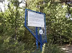
Nevada historical markers identify significant places of interest in Nevada's history. The Historic Marker Program was initiated by the Nevada State Legislature in 1967 to bring the state's heritage to the public's attention with on-site markers. Because of budget cuts the program became dormant in 2009.[1]

List of Nevada historical markers
#Marker nameCounty LocationNotes
1Empire and the Carson River MillsCarson City 39°11′14″N 119°42′23″W / 39.187308°N 119.706364°W / 39.187308; -119.706364 [2]
2Pioneer Memorial ParkHumboldt 40°58′44″N 117°44′31″W / 40.978823°N 117.741971°W / 40.978823; -117.741971 [3]
3West End of Hastings CutoffElko [4]
4Junction House—The First SettlementWashoe 39°29′20″N 119°47′42″W / 39.488881°N 119.794943°W / 39.488881; -119.794943

[5]

5PiocheLincoln 37°55′36″N 114°26′57″W / 37.926679°N 114.449250°W / 37.926679; -114.449250 [6]
6El Dorado CanyonClark 35°49′39″N 114°56′11″W / 35.827629°N 114.936453°W / 35.827629; -114.936453 [7]
7DaytonLyon 39°14′11″N 119°35′21″W / 39.236257°N 119.589297°W / 39.236257; -119.589297 [8]
8AustinLander 39°29′N 117°04′W / 39.49°N 117.07°W / 39.49; -117.07 [9]
9Copper CountryWhite Pine [10]
10Sand MountainChurchill [11]
11EurekaEureka [12]
12Nevada's BirthplaceDouglas [13]
13The Comstock LodeStorey [14]
14GoldfieldEsmeralda [15]
15TonopahNye [16]
16Mineral CountyMineral [17]
17Pershing CountyPershing [1]
18Pyramid LakeWashoe 39°54′10″N 119°33′57″W / 39.902897°N 119.565775°W / 39.902897; -119.565775

[5]

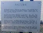
19RagtownChurchill 39°30′21″N 118°55′09″W / 39.505722222222°N 118.91928055556°W / 39.505722222222; -118.91928055556[11]
20ColumbusEsmeralda [15]
21The Humboldt CanalHumboldt [3]
22Humboldt RiverHumboldt [3]
23Humboldt HousePershing [18]
24OlinghouseWashoe [5]
25Nevada's CapitolCarson City [2]
26Forty-Mile DesertChurchill [11]
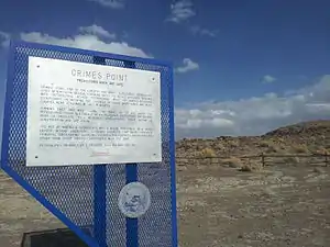
27Grimes PointChurchill Prehistoric rock art site[11]
28Mark TwainStorey [14]
29Chinese in NevadaWashoe 39°32′05″N 119°45′12″W / 39.534713°N 119.753431°W / 39.534713; -119.753431 [5]
30RenoWashoe 39°31′27″N 119°48′45″W / 39.524254°N 119.812417°W / 39.524254; -119.812417

[5]

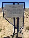
31The Old Spanish Trail (1829-1850)Clark [7]
32The Old Spanish Trail (1829-1850)Clark [7]
33The Old Spanish Trail (1829-1850)Clark [7]
34The Old Spanish Trail (1829-1850)Clark [7]
35Las Vegas Mormon Fort and RanchoClark Nevada's oldest building[7]
36Moapa ValleyClark [7]
37Powell of the ColoradoClark [7]
38Pahranagat ValleyLincoln [6]
39PanacaLincoln Southern Nevada's first permanent settlement, from 1864[6]
40Las Vegas (The Meadows)Clark [7]
41Pueblo Grande de NevadaClark [7]
42Big Smoky ValleyNye [16]
43Derby Diversion DamWashoe [5]
44Carson CityCarson City [2]
45Humboldt WellsElko [4]
46Pilot PeakElko [4]
47Fort Halleck Military ReservationElko 1867-1886[4]
48TuscaroraElko [4]
49Applegate-Lassen Emigrant Trail CutoffPershing [18]
50Carlin CanyonElko [4]
51SchellbourneWhite Pine 39°47′50″N 114°44′28″W / 39.797166666667°N 114.74116666667°W / 39.797166666667; -114.74116666667

[10]

52Cherry CreekWhite Pine [10]
53HamiltonWhite Pine [10]
54Ward Mining DistrictWhite Pine [10]
55Culverwell's RanchLincoln [6]
56Virgin ValleyClark [7]
57Old Boundary (Nevada's Southern Boundary 1861-1867)Lincoln [6]
58Old Boundary (Nevada's Southern Boundary 1861-1867)Nye
59Stokes CastleLander [9]
60Hawthorne (Present Mineral County Seat—Former Esmeralda County Seat)Mineral [19]
61Mound HouseLyon [8]
62Truckee River – WestWashoe 39°30′34″N 119°56′13″W / 39.509479°N 119.936821°W / 39.509479; -119.936821

[5]

63Truckee River – EastWashoe 39°33′00″N 119°34′25″W / 39.550130°N 119.573714°W / 39.550130; -119.573714

[5]

64OphirNye [16]
65PalisadeEureka [12]
66JacobsvilleLander [9]
67Austin ChurchesLander [9]
68WadsworthWashoe [5]
69Jarbidge, NevadaElko [4]
70Bliss MansionCarson City [2]
71Methodist Church of Carson CityCarson City [2]
72Nevada State Children's HomeCarson City [2]
73Unknown SoldiersElko [4]
74WellingtonLyon [8]
75Government BuildingCarson City [2]
76Eagle ValleyCarson City [2]
77Dat-So-La-LeeCarson City [2]
78Orion Clemens' HomeCarson City [2]
79Civil War PlotWashoe 39°32′10″N 119°49′12″W / 39.536177°N 119.820027°W / 39.536177; -119.820027 [5]
80Eureka County CourthouseEureka [12]
81Grand Army Of The Republic Memorial TreeWashoe 39°32′10″N 119°49′01″W / 39.5362352°N 119.8170339°W / 39.5362352; -119.8170339

[5]

82Diamond ValleyEureka [12]
83Rock Creek (Cold Springs Station)Churchill [11]
84Jedediah Strong Smith (Explorer of the Western Wilderness)White Pine 39°17′29″N 114°50′16″W / 39.291497°N 114.837905°W / 39.291497; -114.837905 (reported missing since 2013)[20]
85SutroLyon [8]
86Tule SpringsClark Archeological Site[7]
87Savage Mansion (c. 1863)Storey [14]
88SparksWashoe 39°32′18″N 119°46′01″W / 39.538231°N 119.7670342°W / 39.538231; -119.7670342 [5]
89Paradise ValleyHumboldt [3]
90DelamarLincoln "The Widow Maker" (1893-1909)[6]
91Stewart Indian SchoolCarson City [2]
92Candelaria and Metallic CityMineral [19]
93Panaca Mercantile StoreLincoln Built in 1868 as a cooperative for local commerce and trade from Utah[6]
94The Winters Ranch (Rancho del Sierra)Washoe [5]
95Battle MountainLander [9]
96Round MountainNye 38°44′34″N 117°07′27″W / 38.74277°N 117.124042°W / 38.74277; -117.124042

[16]

97Manhattan "The Pine Tree Camp"Nye [16]
98Osceola (1872-1940)White Pine 39°04′17″N 114°26′58″W / 39.071336111111°N 114.44954722222°W / 39.071336111111; -114.44954722222

[10]

99TaylorWhite Pine [10]
100Nevada Northern RailwayWhite Pine [10]
101Miller'sEsmeralda [15]
102GoodspringsClark 35°49′56″N 115°26′04″W / 35.832203°N 115.434320°W / 35.832203; -115.434320 Mining District (1856-1957)[7]
103Gypsum CaveClark [7]
104The Camel CorpsClark 35°10′20″N 114°42′39″W / 35.172101°N 114.710793°W / 35.172101; -114.710793 [7] Currently MIA, Removed May 2015
105GolcondaHumboldt [3]
106ElkoElko [4]
107Elko AirportElko Terminus of the First Commercial Air Mail Route[4]
108Ruby Valley Pony Express StationElko Reconstructed[4]
109Lamoille ValleyElko [4]
110Wagon Jack ShelterChurchill [11]
111Edwards Creek ValleyChurchill [11]
112CarlinElko [4]
113WabuskaLyon [8]
114FranktownWashoe

[5]

115PotosiClark 36°00′04″N 115°29′07″W / 36.000990°N 115.485413°W / 36.000990; -115.485413 [7]
116SearchlightClark 35°28′06″N 114°55′21″W / 35.468373°N 114.922612°W / 35.468373; -114.922612 [7]
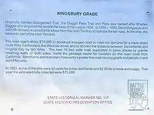
117Kingsbury GradeDouglas 38°57′56″N 119°50′23″W / 38.965531°N 119.839669°W / 38.965531; -119.839669

[13]

118Luther CanyonDouglas Fay Canyon[13]
119Reul Colt GridleyLander [9]
120Walley's Hot SpringsDouglas [13]
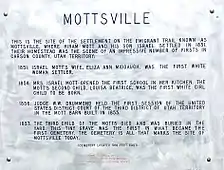
121MottsvilleDouglas 38°55′52″N 119°50′24″W / 38.931094°N 119.840094°W / 38.931094; -119.840094

[13]

122SheridanDouglas [13]
123Cradlebaugh BridgeDouglas [13]
124Boyd Toll RoadDouglas [13]
125Twelve Mile HouseDouglas [13]
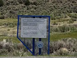
126Double Springs, NevadaDouglas [13]
127Courthouse Site (1865-1907)Lyon [8]
128The Great Train Robbery (Nevada)Washoe 39°31′03″N 119°59′21″W / 39.517531°N 119.9890372°W / 39.517531; -119.9890372 [5]
129GardnervilleDouglas [13]
130MindenDouglas [13]
131DresslervilleDouglas [13]
132Mackay MansionStorey [14]
133Fish Lake ValleyEsmeralda [15]
134Trans-Sierran Pioneer FlightCarson City (March 22, 1919)[2]
135New Pass StationChurchill [11]
136Toquima CaveLander [9]
137Hickison SummitLander [9]
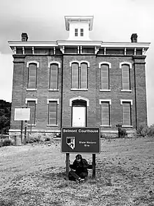
138BelmontNye [16]
139The Old Spanish Trail (Journey of Death)Clark [7]
140The Old Spanish Trail (Garces Expedition)Clark 35°06′24″N 114°39′03″W / 35.106696°N 114.650784°W / 35.106696; -114.650784 [7]
141The Old Spanish Trail (Armijo's Route)Clark 36°05′52″N 114°54′17″W / 36.097650°N 114.904663°W / 36.097650; -114.904663 [7]
142The Old Spanish Trail (Mountain Springs Pass)Clark 35°59′54″N 115°26′52″W / 35.998436°N 115.447723°W / 35.998436; -115.447723 [7]
143Sarah Winnemucca HopkinsHumboldt 1844-1891[3]
144Fort McDermittHumboldt [3]
145Unionville (Pershing County)Pershing [18]
146McDermitt Indian ReservationHumboldt Northern Paiute[3]
147A Home of Early ManChurchill [11]
148The Two Battles Of Pyramid LakeWashoe

[5]

149High Rock CanyonWashoe [5]
150Nevada's First State ParkClark [7]
151Duck Valley Indian ReservationElko [4]
152GerlachWashoe

[5]

153Jarbidge Community HallElko [4]
154BellevilleMineral [19]
155Silver PeakEsmeralda Discovered 1863[15]
156Gold PointEsmeralda [15]
157LidaEsmeralda [15]
158PalmettoEsmeralda [15]
159IoneNye [16]
160Panaca SpringLincoln Warm spring and source of Meadow Valley's fertile lands[6]
161Churchill County CourthouseChurchill [11]
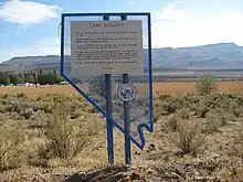
162Camp McGarryHumboldt

[3]

163ChinatownLyon Early Name of Dayton[8]
164Button PointHumboldt [3]
165Nevada Test SiteNye [16]
166Bowers MansionWashoe

[5]

167ValmyHumboldt [3]
168Arrowhead Trail (1914-1924)Clark

[7]

169Glendale SchoolWashoe 39°32′04″N 119°45′20″W / 39.534582°N 119.7554212°W / 39.534582; -119.7554212

[5]

170Eureka Sentinel BuildingEureka [12]
171Chief Tecopa (Peacemaker of the Paiutes)Nye [16]
172TyboNye [16]
173Beatty (Center of the Gold Railroads—"Chicago of the West")Nye

[16]

173Tate's Stage Station (1886-1901)Nye [16]
174BlairEsmeralda [15]
175Stewart-Nye ResidenceCarson City [2]
176The Surveyors (Nevada)Lander

[9]

177Desert Well Station (Overland Mail and Stage Station)Lyon [8]
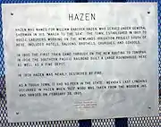
178HazenChurchill [11]
179First Air Flights in NevadaCarson City [2]
180The Warm Springs HotelCarson City [2]
181The Washo IndiansCarson City [2]
182Panaca Ward ChapelLincoln Oldest building in Lincoln County, built in 1867-68 as a LDS Church meetinghouse[6]
183Walker River ReservationMineral [19]
184Ward Charcoal OvensWhite Pine [10]
185McCone's FoundriesLyon [8]
186Union Hotel and Post OfficeLyon [8]
187The Cattle IndustryEureka [12]
188Von Schmidt State Boundary MonumentClark 35°00′51″N 114°39′43″W / 35.014259°N 114.661825°W / 35.014259; -114.661825 [7]
189Southern Pacific Railroad YardsWashoe 39°32′05″N 119°45′11″W / 39.534694°N 119.7531762°W / 39.534694; -119.7531762 [5]
190Original Homesite of Pioneer Las Vegas, "Pop" Squires (1865-1958)Clark [7]
191VerdiWashoe [5]
192Buckland's Station (On the California Emigrant Trail)Lyon 39°17′39″N 119°15′06″W / 39.294221°N 119.251592°W / 39.294221; -119.251592

[8]

193Historic Flume and Lumber YardCarson City [2]
194Gardner's RanchCarson City [2]
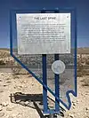
195The Last SpikeClark 35°49′26″N 115°17′14″W / 35.823763°N 115.287155°W / 35.823763; -115.287155 [7]
196The United States Mint at Carson City, NevadaCarson City [2]
197Arrowhead Trail IIClark [7]
198Steamboat SpringsWashoe [5]
199Camels in DaytonLyon [8]
200Hall's StationLyon [8]
201Wonder Historic Mining CampChurchill Historic Mining Camp—1906-1919[11]
202FairviewChurchill 1905-1917[11]
203BullionvilleLincoln [6]
204JackrabbitLincoln [6]
205Crystal SpringsLincoln [6]
206HikoLincoln [6]
207Carson ValleyDouglas [13]
208International HotelLander First commercial building constructed in Austin in 1863[9]
209Chollar MineStorey [14]
210Nevada-California-Oregon Railroad DepotWashoe 39°31′52″N 119°48′36″W / 39.531085°N 119.8101022°W / 39.531085; -119.8101022

[5]

211Old Geiger GradeWashoe

[5]

212GalenaWashoe

[5]

213LakeviewCarson City [2]
214Rafael RiveraClark 36°05′01″N 115°04′22″W / 36.083692°N 115.072761°W / 36.083692; -115.072761 [7]
215Lahontan DamChurchill [11]
216StillwaterChurchill [11]
217Tate's Stage StationNye [16]
218Geiger Station (Magnolia House)Washoe

[5]

219GlenbrookDouglas [13]
220The Fight of the CenturyWashoe 39°31′59″N 119°47′49″W / 39.533192°N 119.7970442°W / 39.533192; -119.7970442 [5]
221Sand HarborWashoe 39°12′02″N 119°55′51″W / 39.2005193°N 119.9307248°W / 39.2005193; -119.9307248 [5]
222Tannehill Cabin—One of Eureka's First HousesEureka [12]
223Devil's GateLyon [8]
224Kyle RanchClark [7]
225Spooner AreaDouglas Logging and Lumber Period: 1868-1895[13]
226Cave RockDouglas [13]
227Lake MansionWashoe 39°31′21″N 119°49′05″W / 39.522562°N 119.8181126°W / 39.522562; -119.8181126 [5]
228The Great Fire of 1875Storey [14]
229Oil from ShaleElko [4]
230Mount Rose Weather ObservatoryWashoe

[5]

231Star CityPershing [18]
232Reunion in UnionvillePershing [18]
233Dayton CemeteryLyon [8]
234Moana SpringsWashoe Maps 39°29′32″N 119°48′03″W / 39.4923328°N 119.800851°W / 39.4923328; -119.800851

[5]

235Camp NyeCarson City [2]
236Piper's Opera HouseStorey [14]
237Carson and Colorado Railroad Freight DepotMineral [19]
238Huffaker'sWashoe

[5]

239StonehouseHumboldt [3]
240Coney IslandWashoe Maps 39°32′06″N 119°46′50″W / 39.535005°N 119.780611°W / 39.535005; -119.780611

[5]

242Southern Nevada Consolidated Telephone-Telegraph Company BuildingEsmeralda [15]
243Corbett—Fitzsimmons FightCarson City 39°09′52″N 119°45′36″W / 39.164475°N 119.759997°W / 39.164475; -119.759997

[2]

244Dinner StationElko [4]
245Frederick Joseph DeLongchamps (June 2, 1882 – February 11, 1969)Washoe 39°31′30″N 119°48′44″W / 39.524964°N 119.812281°W / 39.524964; -119.812281 [5]
246The Great Incline of the Sierra NevadaWashoe 39°14′13″N 119°55′44″W / 39.236813°N 119.928778°W / 39.236813; -119.928778

[5]

247Site of Nevada's First Public LibraryWashoe 39°31′30″N 119°48′44″W / 39.524964°N 119.812281°W / 39.524964; -119.812281

[5]

248Virginia & Truckee Railroad Right of WayWashoe 39°30′53″N 119°48′27″W / 39.5146446°N 119.8075372°W / 39.5146446; -119.8075372

[5]

249Union Pacific Depot—1923Lincoln [6]
250State Printing BuildingCarson City [2]
251Diamondfield Jack DavisElko [4]
252Rinckel MansionCarson City [2]
253Emigrant—Donner CampWashoe 39°28′34″N 119°45′15″W / 39.476005°N 119.754087°W / 39.476005; -119.754087

[5]

254Nevada's Mining HeritageEureka [12]
255Wilson CanyonLyon [8]
256Historic TransportationWashoe [5]
257Nevada's First Gold DiscoveryLyon [8]
258Charles W. Friend House, Observatory, and Weather StationCarson City [2]
259The Governor's MansionCarson City [2]
260ContactElko [4]
261Spooner SummitDouglas [13]
262Dayton School House - 1865Lyon [8]
263Oats Park SchoolChurchill [11]
265Governor Emmet Derby BoyleWashoe [5]
266African Americans and the Boston SaloonStorey [14]

Notes

  1. 1 2 "Historical Markers". Nevada State Historic Preservation Office. Retrieved 25 March 2017.
  2. 1 2 3 4 5 6 7 8 9 10 11 12 13 14 15 16 17 18 19 20 21 22 23 24 25 26 "Carson City, Nevada". Nevada. Retrieved 17 July 2011.
  3. 1 2 3 4 5 6 7 8 9 10 11 12 "Humboldt County, Nevada". Nevada. Retrieved 18 July 2011.
  4. 1 2 3 4 5 6 7 8 9 10 11 12 13 14 15 16 17 18 19 "Elko Nevada". Nevada. Retrieved 18 July 2011.
  5. 1 2 3 4 5 6 7 8 9 10 11 12 13 14 15 16 17 18 19 20 21 22 23 24 25 26 27 28 29 30 31 32 33 34 35 36 37 38 39 40 41 "Washoe County, Nevada". Nevada. Retrieved 18 July 2011.
  6. 1 2 3 4 5 6 7 8 9 10 11 12 13 14 "Lincoln County, Nevada". Nevada. Retrieved 18 July 2011.
  7. 1 2 3 4 5 6 7 8 9 10 11 12 13 14 15 16 17 18 19 20 21 22 23 24 25 26 27 28 29 "Clark County, Nevada". Nevada. Retrieved 18 July 2011.
  8. 1 2 3 4 5 6 7 8 9 10 11 12 13 14 15 16 17 18 "Lyon County, Nevada". Nevada. Retrieved 18 July 2011.
  9. 1 2 3 4 5 6 7 8 9 10 "Lander County, Nevada". Nevada. Retrieved 18 July 2011.
  10. 1 2 3 4 5 6 7 8 9 "White Pine County, Nevada". Nevada. Retrieved 18 July 2011.
  11. 1 2 3 4 5 6 7 8 9 10 11 12 13 14 15 16 "Churchill County, Nevada". Nevada. Retrieved 18 July 2011.
  12. 1 2 3 4 5 6 7 8 "Eureka County, Nevada". Nevada. Retrieved 18 July 2011.
  13. 1 2 3 4 5 6 7 8 9 10 11 12 13 14 15 16 17 18 "Douglas County, Nevada". Nevada. Retrieved 18 July 2011.
  14. 1 2 3 4 5 6 7 8 "Storey County, Nevada". Nevada. Retrieved 18 July 2011.
  15. 1 2 3 4 5 6 7 8 9 10 "Esmeralda County, Nevada". Nevada. Retrieved 18 July 2011.
  16. 1 2 3 4 5 6 7 8 9 10 11 12 13 "Nye County, Nevada". Nevada. Retrieved 18 July 2011.
  17. "Nevada Historical Markers". Nevada State Historic Preservation Office. Archived from the original on 4 February 2013. Retrieved 24 February 2013.
  18. 1 2 3 4 5 "Pershing County, Nevada". Nevada. Retrieved 18 July 2011.
  19. 1 2 3 4 5 "Mineral County, Nevada". Nevada. Retrieved 18 July 2011.
  20. Marker Statement
This article is issued from Wikipedia. The text is licensed under Creative Commons - Attribution - Sharealike. Additional terms may apply for the media files.