Trunk 6 | ||||
|---|---|---|---|---|
| Route information | ||||
| Maintained by Department of Transportation and Infrastructure Renewal | ||||
| Length | 136.4 km[1] (84.8 mi) | |||
| Major junctions | ||||
| West end | ||||
| East end | ||||
| Location | ||||
| Country | Canada | |||
| Province | Nova Scotia | |||
| Counties | Cumberland, Colchester, Pictou | |||
| Towns | Amherst, Pictou | |||
| Highway system | ||||
| ||||

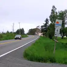
Trunk 6 is part of the Canadian province of Nova Scotia's system of trunk highways. The route runs from Highway 104 exit 3 at Amherst to the rotary at Pictou, a distance of 136 kilometres (85 mi).[1] It is part of the Sunrise Trail, a designated tourist route.[2]
Route description
For most of its length Trunk 6 is a two lane highway with a speed limit of 80 km/h (50 mph). In communities, villages or towns the speed limit may drop to as low as 50 km/h (30 mph).
From Amherst, Trunk 6 goes in an easterly direction to the village of Port Philip, where it meets the Northumberland Strait. The route then follows the strait's shoreline through Pugwash, Wallace and Tatamagouche to the town of Pictou.[2]
Until the construction of Highway 106 in the late 1960s, Trunk 6 continued south to New Glasgow on the Alma Road and Trunk 4.
Communities
- Amherst (Victoria Street East and Victoria Street West)
- East Amherst
- Shinimicas Bridge
- Port Howe
- Port Philip
- Pugwash
- Wallace
- Tatamagouche
- River John
- Toney River
- Pictou
Major intersections
| County | Location | km[1] | mi | Exit | Destinations | Notes |
|---|---|---|---|---|---|---|
| Cumberland | Amherst | 0.0– 0.4 | 0.0– 0.25 | Hwy 104 exit 3; western terminus | ||
| 2.8 | 1.7 | South end of Trunk 2 concurrency | ||||
| 2.9 | 1.8 | North end of Trunk 2 concurrency | ||||
| East Amherst | 3.6 | 2.2 | ||||
| Port Howe | 41.9 | 26.0 | ||||
| 43.1 | 26.8 | |||||
| ↑ / ↓ | 44.2 | 27.5 | Crosses the River Philip | |||
| Port Philip | 44.4 | 27.6 | ||||
| Pugwash | 50.9 | 31.6 | Crosses the Pugwash River | |||
| Head of Wallace Bay | 58.7 | 36.5 | ||||
| Wallace Bridge | 64.2 | 39.9 | Crosses the Wallace River | |||
| Wallace | 67.6 | 42.0 | ||||
| Colchester | Tatamagouche | 86.9 | 54.0 | |||
| 88.1 | 54.7 | |||||
| Brule Corner | 98.0 | 60.9 | ||||
| Pictou | River John | 107.6 | 66.9 | Crosses the River John | ||
| Pictou | 136.4 | 84.8 | 3D | Pictou Rotary Signed as exit 3C to Trunk 6 west; eastern terminus; exit numbers follow Hwy 106 | ||
| 3E | ||||||
| 3A | West River Road – Pictou | |||||
| 3B | ||||||
1.000 mi = 1.609 km; 1.000 km = 0.621 mi
| ||||||
See also
References
- 1 2 3 Google (March 6, 2020). "Nova Scotia Trunk 6" (Map). Google Maps. Google. Retrieved March 6, 2020.
- 1 2 Nova Scotia Road Map (Map). 1:640,000. Province of Nova Scotia. 2019. §§ E-6, E-7, F-6, F-7, F-8, F-9.