38°34′53″N 120°34′24″W / 38.58139°N 120.57333°W
Omo Ranch | |
|---|---|
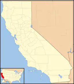 Omo Ranch Location in California  Omo Ranch Omo Ranch (the United States) | |
| Coordinates: 38°34′53″N 120°34′24″W / 38.58139°N 120.57333°W | |
| Country | United States |
| State | California |
| County | El Dorado County |
| Elevation | 3,612 ft (1,101 m) |
| Population (2010) | |
| • Total | 284 |
Omo Ranch is an unincorporated community in El Dorado County, California.[1] It is located 12.5 miles (20 km) south-southeast of Camino,[2] at an elevation of 3612 feet (1101 m).[1]
Omo Ranch was once a logging town with a sawmill; the mill closed in 1973.[3] Today, Omo Ranch is a rural residential area with few county services. Its population in 1986 was estimated at about 150.[4]
A post office operated at Omo Ranch from 1888 to 1974.[2] The name Omo comes from a Native American village.[2]
References
- 1 2 3 U.S. Geological Survey Geographic Names Information System: Omo Ranch, California
- 1 2 3 Durham, David L. (1998). California's Geographic Names: A Gazetteer of Historic and Modern Names of the State. Clovis, Calif.: Word Dancer Press. p. 533. ISBN 1-884995-14-4.
- ↑ Wiley, Walt (October 16, 1991). "This forest is full of memories". The Sacramento Bee. Sacramento, CA. Retrieved December 27, 2023.
- ↑ Lambert, Marjie (February 10, 1986). "Prospect of prison camp alarms tiny, ridgetop village". The Sacramento Bee. Sacramento, CA. Retrieved December 27, 2023.
Municipalities and communities of El Dorado County, California, United States | ||
|---|---|---|
| Cities |  El Dorado County map | |
| CDPs | ||
| Unincorporated communities |
| |
| Former settlements | ||
| Footnotes | ‡This CDP also has portions in an adjacent county or counties | |
This article is issued from Wikipedia. The text is licensed under Creative Commons - Attribution - Sharealike. Additional terms may apply for the media files.