Onhaye
| |
|---|---|
.JPG.webp) Onhaye town hall | |
 Coat of arms | |
Location of Onhaye | |
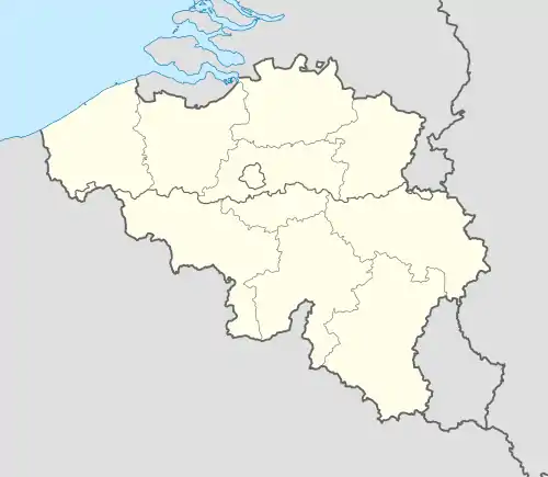 Onhaye Location in Belgium
Location of Onhaye in Namur province 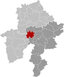 | |
| Coordinates: 50°15′N 04°50′E / 50.250°N 4.833°E | |
| Country | |
| Community | French Community |
| Region | Wallonia |
| Province | Namur |
| Arrondissement | Dinant |
| Government | |
| • Mayor | Christophe Bastin |
| • Governing party/ies | ICO |
| Area | |
| • Total | 65.67 km2 (25.36 sq mi) |
| Population (2018-01-01)[1] | |
| • Total | 3,201 |
| • Density | 49/km2 (130/sq mi) |
| Postal codes | 5520-5524 |
| NIS code | 91103 |
| Area codes | 082 |
| Website | www.onhaye.be |
Onhaye (French pronunciation: [ɔ̃ɛ]) is a municipality of Wallonia located in the province of Namur, Belgium.
On 1 January 2006 Onhaye had a total population of 3,120. The total area is 65.53 km2 (25.30 sq mi) which gives a population density of 48 inhabitants per square kilometre (120/sq mi).
The municipality consists of the following districts: Anthée, Falaën, Gerin, Onhaye, Serville, Sommière, and Weillen.
The region is home to several cultural heritage monuments, such as Château de Fontaine and the fortified farmhouse Falaën Castle.
.JPG.webp)
Château de Fontaine, west of Onhaye
See also
References
- ↑ "Wettelijke Bevolking per gemeente op 1 januari 2018". Statbel. Retrieved 9 March 2019.
External links
 Media related to Onhaye at Wikimedia Commons
Municipalities in the province of Namur, Wallonia | ||
|---|---|---|
| Dinant |  | |
| Namur | ||
| Philippeville | ||
Bold indicates cities | ||
This article is issued from Wikipedia. The text is licensed under Creative Commons - Attribution - Sharealike. Additional terms may apply for the media files.