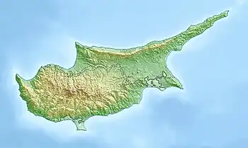
Palaikythro
| |
|---|---|
village | |
 Palaikythro Location in Cyprus | |
| Coordinates: 35°12′24″N 33°29′36″E / 35.20667°N 33.49333°E | |
| Country (de jure) | |
| • District | Nicosia District |
| Country (de facto) | |
| • District | Lefkoşa District |
| Time zone | UTC+2 (EET) |
| • Summer (DST) | UTC+3 (EEST) |
Palaikythro (Greek: Παλαίκυθρο, Turkish: Balıkesir) is a village in the Nicosia District of Cyprus, located 6 km south of Kythrea, on the main Nicosia-Famagusta highway. The village is under de facto control of Northern Cyprus.
References
- ↑ In 1983, the Turkish Republic of Northern Cyprus unilaterally declared independence from the Republic of Cyprus. The de facto state is not recognised by any UN state except Turkey.
This article is issued from Wikipedia. The text is licensed under Creative Commons - Attribution - Sharealike. Additional terms may apply for the media files.

