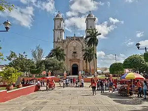
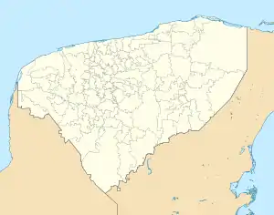
Peto | |
|---|---|
Municipal Seat | |
 Church in Peto | |
 Coat of arms | |
 Peto | |
| Coordinates: 20°07′32″N 88°55′17″W / 20.12556°N 88.92139°W | |
| Country | |
| State | Yucatán |
| Municipality | Peto |
| Founded | 1549 |
| Elevation | 40 m (130 ft) |
| Population (2010) | |
| • Total | 19,821[1] |
| Time zone | UTC-6 (Central Standard Time) |
| • Summer (DST) | UTC-5 (Central Daylight Time) |
| Postal code | 97930 |
| Area code | 997 |
| Demonym | petuleño, petuleña |
Peto is a town and the municipal seat of the Peto Municipality, Yucatán in Mexico. As of 2010, the town has a population of 19,821.[1]
Etymology
From the Maya pet crown and uj moon thus meaning crowned moon, in reference to a lunar halo.

Demographics
Geography
Climate
| ||||||||||||||||||||||||||||||||||||||||||||||||||||||||||||||||||||||||||||||||||||||||||||||||||||||||||||||||||||||||||||
List of mayors
- Gerónimo Sánchez (1941-1942)
- Wilfrido Alonso (1943-1944)
- Pedro Muñoz Sánchez (1945-1946)
- Francisco Trejo (1947-1949)
- Rosendo Arrollo (1950-1952)
- Guillermo Baduy Ayala (1953-1955)
- José I. Hernández (1956-1958)
- Nicolás Sogbi Canto (1959-1961)
- Casildo Arroyo (1962-1963)
- Juan Escamilla Sosa (1963)
- Sergio Salazar López (1963-1967)
- Zenón Muñoz Martínez (1968-1970)
- César A. Ruiz V. (1971-1973)
- Mario Arturo Pérez (1974-1975)
- Sergio Salazar López (1976-1978)
- Roger Calero Muñoz (1979-1981)
- Felipe Sosa Buenfil (1982-1984)
- Gilberto Góngora Sánchez (1985-1987)
- Héctor Sosa Duarte (1988-1990)
- José Vicente Domínguez Canto (1991-1993)
- Castulo Ake Can (1994-1995)
- Samuel Castillo Yah (1996-1998)
- Ruperto Sánchez Uluhac -(1999-2001)
- Jorge Román Avilez y Manzanilla (2001-2004)
- Gilberto Alonso Navarrete Vázquez (2004-2007)
- José Vicente Domínguez Canto (2007-2010)
- Martha Raquel González Cámara (2010-2012)
- Higinio Chan Acosta (2012-2015)
- Jaime Ariel Hernández Santos (2015-2018)
- Edgar Román Calderón Sosa (2018-2021)
References
- 1 2 "Population and Housing Census 2010". INEGI.org. National Institute of Statistics and Geography. 2010. Retrieved 5 July 2018.
- ↑ "NASA Earth Observations Data Set Index". NASA. Retrieved 30 January 2016.
- ↑ Peel, M C; Finlayson, B L (2007). "Updated world map of the Köppen-Geiger climate classification". Hydrology and Earth System Sciences. 11 (5): 1633–1644. Bibcode:2007HESS...11.1633P. doi:10.5194/hess-11-1633-2007. Retrieved 30 January 2016.
This article is issued from Wikipedia. The text is licensed under Creative Commons - Attribution - Sharealike. Additional terms may apply for the media files.
