Pine Township | |
|---|---|
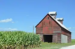 Cornfield and grain crib on E100N | |
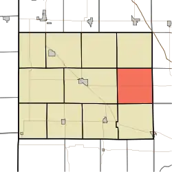 Location of Pine Township in Benton County | |
| Coordinates: 40°35′56″N 87°09′03″W / 40.59889°N 87.15083°W | |
| Country | United States |
| State | Indiana |
| County | Benton |
| Organized | July 1840 |
| Government | |
| • Type | Indiana township |
| Area | |
| • Total | 35.66 sq mi (92.4 km2) |
| • Land | 35.66 sq mi (92.4 km2) |
| • Water | 0 sq mi (0 km2) |
| Elevation | 735 ft (224 m) |
| Population (2020) | |
| • Total | 324 |
| • Density | 9.0/sq mi (3.5/km2) |
| Time zone | UTC-5 (EST) |
| • Summer (DST) | UTC-4 (EDT) |
| FIPS code | 18-59886[2] |
| GNIS feature ID | 453738 |
Pine Township is one of eleven townships in Benton County, Indiana. As of the 2020 census, its population was 324 and it contained 108 housing units.[3] Pine Township was one of the original three created by county commissioners in July 1840, and is named for Big Pine Creek which flows south through the township.[4]
Geography
According to the 2020 census, the township has a total area of 35.66 square miles (92.4 km2), all land.[3]
Adjacent townships
- Bolivar (south)
- Center (west)
- Gilboa (north)
- Oak Grove (southwest)
- Union (northwest)
- Round Grove Township, White County (east)
- Shelby Township, Tippecanoe County (southeast)
- West Point Township, White County (northeast)
Major highways
References
- ↑ "US Board on Geographic Names". United States Geological Survey. October 25, 2007. Retrieved January 31, 2008.
- ↑ "U.S. Census website". United States Census Bureau. Retrieved January 31, 2008.
- 1 2 "Explore Census Data". US Census Bureau. Retrieved February 18, 2022.
- ↑ Birch, Jesse Setlington (1942) [1928]. History of Benton County and Historic Oxford. Oxford, Indiana: Craw & Craw, Inc. p. 21.
External links
Wikimedia Commons has media related to Pine Township, Benton County, Indiana.
Municipalities and communities of Benton County, Indiana, United States | ||
|---|---|---|
| Towns | Map of Indiana highlighting Benton County | |
| Townships | ||
| CDPs | ||
| Other communities |
| |
| Ghost towns | ||
| Footnotes | ‡This populated place also has portions in an adjacent county or counties | |
This article is issued from Wikipedia. The text is licensed under Creative Commons - Attribution - Sharealike. Additional terms may apply for the media files.