Pleasant Grove, Arkansas | |
|---|---|
 Pleasant Grove, Arkansas  Pleasant Grove, Arkansas | |
| Coordinates: 35°48′59″N 91°54′34″W / 35.81639°N 91.90944°W | |
| Country | United States |
| State | Arkansas |
| County | Stone |
| Elevation | 463 ft (141 m) |
| Population (2020) | |
| • Total | 235 |
| Time zone | UTC-6 (Central (CST)) |
| • Summer (DST) | UTC-5 (CDT) |
| ZIP code | 72567 |
| Area code | 870 |
| GNIS feature ID | 2805677[1] |
Pleasant Grove is an unincorporated community and census-designated place (CDP) in Stone County, Arkansas, United States. It was first listed as a CDP in the 2020 census with a population of 235.[2] Pleasant Grove is located along Arkansas Highway 14, 12.5 miles (20.1 km) east-southeast of Mountain View. Pleasant Grove has a post office with ZIP code 72567.[3]
Demographics
2020 census
| Race / Ethnicity | Pop 2020[4] | % 2020 |
|---|---|---|
| White alone (NH) | 222 | 94.47% |
| Black or African American alone (NH) | 1 | 0.43% |
| Native American or Alaska Native alone (NH) | 1 | 0.43% |
| Asian alone (NH) | 0 | 0.00% |
| Pacific Islander alone (NH) | 1 | 0.43% |
| Some Other Race alone (NH) | 0 | 0.00% |
| Mixed Race/Multi-Racial (NH) | 7 | 2.98% |
| Hispanic or Latino (any race) | 3 | 1.28% |
| Total | 235 | 100.00% |
References
- 1 2 U.S. Geological Survey Geographic Names Information System: Pleasant Grove, Stone County, Arkansas
- ↑ "Pleasant Grove CDP, Arkansas". United States Census Bureau. Retrieved April 7, 2022.
- ↑ ZIP Code Lookup
- ↑ "P2 HISPANIC OR LATINO, AND NOT HISPANIC OR LATINO BY RACE – 2020: DEC Redistricting Data (PL 94-171) – Pleasant Grove CDP, Arkansas". United States Census Bureau.
Municipalities and communities of Stone County, Arkansas, United States | ||
|---|---|---|
| Cities | 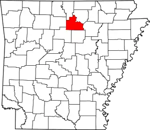 Map of Arkansas highlighting Stone County | |
| CDPs | ||
| Other unincorporated communities | ||
| Ghost town | ||
This article is issued from Wikipedia. The text is licensed under Creative Commons - Attribution - Sharealike. Additional terms may apply for the media files.