West Richwoods, Arkansas | |
|---|---|
 | |
 West Richwoods, Arkansas  West Richwoods, Arkansas | |
| Coordinates: 35°49′35″N 92°10′19″W / 35.82639°N 92.17194°W | |
| Country | United States |
| State | Arkansas |
| County | Stone |
| Elevation | 1,030 ft (310 m) |
| Time zone | UTC-6 (Central (CST)) |
| • Summer (DST) | UTC-5 (CDT) |
| Area code | 870 |
| GNIS feature ID | 78728[1] |
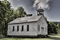
West Richwoods is an unincorporated community in Stone County, Arkansas, United States. West Richwoods is located on Arkansas Highway 9, 4.2 miles (6.8 km) southwest of Mountain View.[2] The Samuel Brown House and the West Richwoods Church & School, which are both listed on the National Register of Historic Places, are located in West Richwoods.[3]
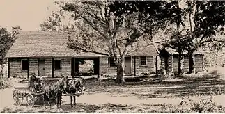
Original Samuel Brown House in 1845
References
- ↑ "West Richwoods". Geographic Names Information System. United States Geological Survey, United States Department of the Interior.
- ↑ Stone County, Arkansas General Highway Map (PDF) (Map). Arkansas State Highway and Transportation Department. 2001. Retrieved December 2, 2012.
- ↑ "National Register Information System". National Register of Historic Places. National Park Service. July 9, 2010.
Municipalities and communities of Stone County, Arkansas, United States | ||
|---|---|---|
| Cities | 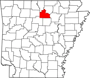 Map of Arkansas highlighting Stone County | |
| CDPs | ||
| Other unincorporated communities | ||
| Ghost town | ||
This article is issued from Wikipedia. The text is licensed under Creative Commons - Attribution - Sharealike. Additional terms may apply for the media files.