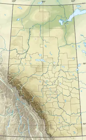
Port Cornwall
Fort Cornwall / Mirror Landing | |
|---|---|
Former village | |
 Port Cornwall Location of Port Cornwall  Port Cornwall Port Cornwall (Alberta) | |
| Coordinates: 55°10′01″N 114°03′30″W / 55.16694°N 114.05833°W | |
| Country | Canada |
| Province | Alberta |
| Region | Northern Alberta |
| Census division | 17 |
| Municipal district (MD) | MD of Lesser Slave River No. 124 |
| Incorporated (village)[1] | October 27, 1913 |
| Dissolved[2] | September 11, 1917 |
| Government | |
| • Type | Unincorporated |
| • Governing body | MD of Lesser Slave River No. 124 Council |
| Time zone | UTC−07:00 (MST) |
| • Summer (DST) | UTC−06:00 (MDT) |
| Area code(s) | 780, 587, 825 |
| Waterways | Athabasca River, Lesser Slave River |
Port Cornwall, also known as Fort Cornwall, is a former village in northern Alberta, Canada within the Municipal District of Lesser Slave River No. 124.[3] Prior to incorporation as a village, the community was known as Mirror Landing.[4]
Port Cornwall was located on the north shore of the Lesser Slave River at its confluence with the Athabasca River.[4] The Hamlet of Smith is located 1.4 km (0.87 mi) southeast of the former village across the Athabasca River.
History
In the late 19th century, Mirror Landing was a stopping point along a trail for travellers to the Peace Country from Fort Edmonton via Athabasca Landing. By 1911, Mirror Landing was one of numerous stopping points for unimpeded steamboat travel between Athabasca Landing and Lesser Slave Lake.[5]
The community was incorporated as the Village of Fort Cornwall on October 27, 1913,[1] although it was referred to as Port Cornwall as early as January 1914.[4] According to Alberta Municipal Affairs, Port Cornwall had a population of 200 in 1913.[6]
By early 1914, the village had over 30 businesses and numerous residences. Infrastructure included streetlights and sidewalks. It also included a government telegraph office and quarters for the Royal North-West Mounted Police. At this time, plans were also underway for the building of a school and a Methodist church.[4]
However, early 1914 would also spell the beginning of the end for the village. The Edmonton, Dunvegan and British Columbia Railway had reached the present location of Smith, across the confluence of the Lesser Slave and Athabasca rivers from Port Cornwall. Subdivision of the Smith townsite began as a result, and Port Cornwall's demise began.[5]
Ultimately, the Village of Port Cornwall later disorganized on September 11, 1917.[2]
See also
References
- 1 2 "Notice – Village of Fort Cornwall (excerpt from The Alberta Gazette, November 15, 1913)" (PDF). Alberta Municipal Affairs. November 15, 1913. Retrieved July 5, 2011.
- 1 2 "Notice – Village of Port Cornwall (excerpt from The Alberta Gazette, September 29, 1917)" (PDF). Alberta Municipal Affairs. September 29, 1917. Retrieved July 5, 2011.
- ↑ "Municipal Boundary Document Search: Municipal District of Lesser Slave River No. 124". Alberta Municipal Affairs. 2011. Retrieved July 5, 2011.
- 1 2 3 4 "Mirror Landing is now Port Cornwall". Edmonton Daily Bulletin. January 15, 1914. Archived from the original on September 24, 2015. Retrieved July 5, 2011.
- 1 2 Leonard, David; Stelfox, Brad; Wynes, Bob (September 1999). "A Physical, Biological and Land Use Synopsis of the Boreal Forest's Natural Regions of Northwest Alberta, Chapter 6 – Humans: Their Demographics, Employment, & Infrastructure" (PDF). Archived from the original (PDF) on March 26, 2012. Retrieved July 5, 2011.
- ↑ "Population Data 1913" (PDF). Alberta Municipal Affairs. 1913. Retrieved July 5, 2011.
External links
- View of Port Cornwall, 1914 – Library and Archives Canada