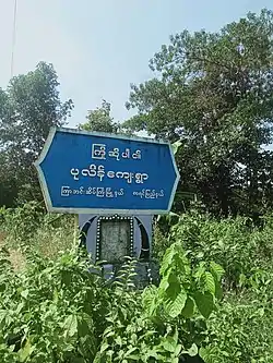
Pu Lein | |
|---|---|
Village | |
 | |
 Pu Lein Location in Burma | |
| Coordinates: 16°3′36″N 97°53′1″E / 16.06000°N 97.88361°E | |
| Country | |
| State | |
| District | Kawkareik District |
| Township | Kyain Seikgyi Township |
| Time zone | UTC+6.30 (MST) |
| Area code | 58[1] |
Pu Lein[2] is a village in Kyain Seikgyi Township, Kawkareik District, in the Kayin State of Myanmar. It is located east side of the Tenasserim Range and west of Tagundaing in Kayin State along Ta Khun Taing - Abit Road.
References
- ↑ "Myanmar Area Codes". Archived from the original on 2009-12-01. Retrieved 2009-04-10.
- ↑ "Kyainseikgyi Township of Kawkareik District" (PDF). Myanmar Information Management Unit (MIMU). 3 May 2016. Retrieved 22 November 2017.
This article is issued from Wikipedia. The text is licensed under Creative Commons - Attribution - Sharealike. Additional terms may apply for the media files.
