Route 393 | ||||
|---|---|---|---|---|
 | ||||
| Route information | ||||
| Maintained by Transports Québec | ||||
| Length | 98 km[1] (61 mi) | |||
| Major junctions | ||||
| South end | ||||
| North end | Val-Paradis in 'Baie-James (Route-des-Richesses) | |||
| Location | ||||
| Country | Canada | |||
| Province | Quebec | |||
| Major cities | Rouyn-Noranda, La Sarre | |||
| Highway system | ||||
| ||||

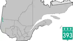
Route 393 is a Quebec provincial highway located in the province's Abitibi-Témiscamingue and Nord-du-Québec regions. The highway runs from the junction of Route 101 in the Rouyn-Noranda suburb of Destor and ends in Val-Paradis in the municipality of Baie-James. In La Sarre it overlaps Route 111.
Municipalities along Route 393
.jpg.webp)
Quebec Route 393 in Rouyn-Noranda
See also
References
- ↑ Ministère des transports, "Distances routières", page 95, Les Publications du Québec, 2005
External links
- Official Transports Quebec Map (in French)
- Route 393 on Google Maps
This article is issued from Wikipedia. The text is licensed under Creative Commons - Attribution - Sharealike. Additional terms may apply for the media files.