Reisdorf
Reisduerf | |
|---|---|
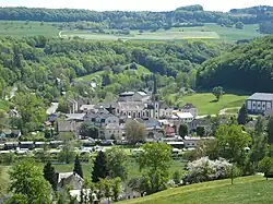 Reisdorf seen from the north | |
 Coat of arms | |
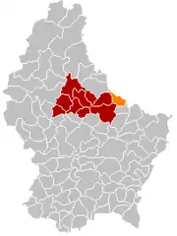 Map of Luxembourg with Reisdorf highlighted in orange, and the canton in dark red | |
| Coordinates: 49°52′00″N 6°16′00″E / 49.8667°N 6.2667°E | |
| Country | |
| Canton | Diekirch |
| Area | |
| • Total | 14.84 km2 (5.73 sq mi) |
| • Rank | 80th of 102 |
| Highest elevation | 406 m (1,332 ft) |
| • Rank | 44th of 102 |
| Lowest elevation | 175 m (574 ft) |
| • Rank | 15th of 102 |
| Population (2023) | |
| • Total | 1,353 |
| • Rank | 96th of 102 |
| • Density | 91/km2 (240/sq mi) |
| • Rank | 70th of 102 |
| Time zone | UTC+1 (CET) |
| • Summer (DST) | UTC+2 (CEST) |
| LAU 2 | LU0000608 |
| Website | reisdorf.lu |
Reisdorf (Luxembourgish: Reisduerf) is a commune and small town in eastern Luxembourg, on the river Sauer. It is part of the canton of Diekirch.
In 2020, Reisdorf, which lies in the centre of the commune, had a population of 1276. Other towns within the commune include Bigelbach, Hoesdorf, and Wallendorf-Pont.
Population
Gallery
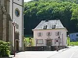 Reisdorf town hall
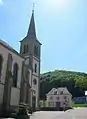 Reisdorf town hall and church
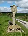 Wayside cross at the N10, just outside the town
 Panorama between Reisdorf and Beaufort
References
- ↑ "Population par canton et commune". statistiques.public.lu. Retrieved 11 January 2022.
External links
 Media related to Reisdorf (Luxembourg) at Wikimedia Commons
Places adjacent to Reisdorf | ||||||||||||||||
|---|---|---|---|---|---|---|---|---|---|---|---|---|---|---|---|---|
| ||||||||||||||||
 | ||
This article is issued from Wikipedia. The text is licensed under Creative Commons - Attribution - Sharealike. Additional terms may apply for the media files.