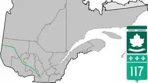
Route 117 | ||||
|---|---|---|---|---|
| Route Transcanadienne | ||||
 | ||||
| Route information | ||||
| Maintained by Transports Québec | ||||
| Length | 663.9 km[1] (412.5 mi) | |||
| History | ||||
| Major junctions | ||||
| South end | ||||
| North end | ||||
| Location | ||||
| Country | Canada | |||
| Province | Quebec | |||
| Highway system | ||||
| ||||


Route 117, the Trans Canada Highway Northern Route, is a provincial highway within the Canadian province of Quebec, running between Montreal and the Quebec/Ontario border where it continues as Highway 66 east of McGarry, Ontario. It is an important road since it is the only direct route between southern Quebec and the Abitibi-Témiscamingue region.
Route 117 was formerly Route 11 and ran from Montreal north towards Mont-Laurier and then followed the Gatineau River south towards Gatineau. This routing is joined with Autoroute 15 from Montreal northwards towards Mont Tremblant. Route 117 also takes in the former Quebec Routes 58 and 59.
Along with Autoroute 15 to Sainte-Agathe-des-Monts, it is also listed as a branch of the Trans-Canada Highway. Ontario Highway 17 is also a branch of the Trans-Canada Highway but is an unrelated route that parallels it by about 200 km (120 mi).
Route description
This description of Route 117 follows it from southeast to northwest.
Route 117 starts in Montreal at the Decarie Interchange where Autoroute 40 and Autoroute 15 (Decarie Expressway) meet. Montrealers sometimes unofficially extend Route 117 along the portion of Decarie Boulevard that runs parallel to the Decarie Expressway.
From the Decarie Interchange, Route 117 goes north on Marcel-Laurin Boulevard to Keller Boulevard. It continues from Laurentian Boulevard to Keller Boulevard, southbound only, or on Lachapelle Street from Keller Boulevard, northbound only, and crosses the Rivière des Prairies over the Lachapelle Bridge to Île Jésus. It continues through the Laval neighborhoods of Chomedey, Fabreville and Sainte-Rose, northbound as Boulevard Curé-Labelle, Boulevard Chomedey at the former Chenoy's deli, left turn at Boulevard Cartier and back into Boulevard Curé-Labelle, southbound as Boulevard Curé-Labelle.
At the Rivière des Mille Îles, it crosses over the Marius Dufresne Bridge to the "North Shore" (of the Rivière des Mille Îles). Then, Route 117 runs parallel to Autoroute 15 until Sainte-Agathe-des-Monts and goes through the Laurentian mountains. Towns along the route in this section include:
- Rosemère
- Sainte-Thérèse
- Blainville
- Mirabel
- Saint-Jérôme
- Prévost
- Piedmont
- Sainte-Adèle
- Val Morin
- Val-David
- Sainte-Agathe-des-Monts
After Sainte-Agathe-des-Monts, Route 117 continues as a four-lane divided highway and winds its way through Laurentides Regional County Municipality until it reaches the town of Labelle. From then on to the Ontario border, Route 117 is mostly a standard two-lane highway. In Grand-Remous, Route 117 crosses the Gatineau River and intersects with Route 105, which goes southwest to Maniwaki and Gatineau. Towns along the route in this section include:
- Mont-Blanc
- Mont-Tremblant
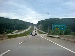
- La Conception
- Labelle
- Rivière-Rouge
- Lac-Saguay
- Lac-des-Écorces
- Mont-Laurier
- Grand-Remous
From Grand-Remous, the route heads north for some 220 km (140 mi) through undeveloped wilderness, most of which is part of La Vérendrye Wildlife Reserve. While the reserve is popular for a variety of outdoor activities, services along the road are sparse. This section is often considered one of the most dangerous routes in the province because of numerous fatal accidents, some involving tractor-trailers. During the winter, the route is often extremely slippery, even during dry and clear days. The few communities along this section are:
After the intersection with Route 113, which continues north to Lebel-sur-Quévillon, Route 117 heads west to Ontario where it becomes Highway 66. The section between Rouyn-Noranda and Arntfield runs concurrent with Route 101. Towns along the route in this section include:
Major intersections
| RCM | Location | km[1] | mi | Exit | Destinations | Notes |
|---|---|---|---|---|---|---|
| Montréal | Montréal | 0.0 | 0.0 | Décarie Interchange A-15 exit 70; A-40 exit 66; R-117 follows Boulevard Marcel-Laurin | ||
| Boulevard Décarie | Northbound exit and southbound entrance | |||||
| 2.0 | 1.2 | Boulevard Côte-Vertu | ||||
| 4.1 | 2.5 | Boulevard Henri Bourassa | Becomes Boulevard Laurentien north of intersection | |||
| 4.6 | 2.9 | Boulevard Keller | South end of one-way pair; northbound follows Rue Lachapelle; southbound follows Boulevard Laurentien | |||
| 5.6 | 3.5 | Boulevard Gouin | ||||
| 5.9 | 3.7 | One way transition | North end of one-way pair | |||
| Rivière des Prairies | 6.0– 6.3 | 3.7– 3.9 | Pont Lachapelle (Lachapelle Bridge) | |||
| Laval | 7.0 | 4.3 | Chomedey Boulevard / Cartier Boulevard | |||
| 9.8 | 6.1 | Boulevard Saint-Martin | Former R-148 | |||
| 11.7 | 7.3 | A-440 exit 19 | ||||
| 14.5 | 9.0 | A-15 exit 14 | ||||
| Rivière des Mille Îles | 17.6– 18.1 | 10.9– 11.2 | Pont Marius-Dufresne (Marius Dufresne Bridge) | |||
| Thérèse-De Blainville | Rosemère | 19.1 | 11.9 | |||
| Rosemère – Sainte-Thérèse boundary | 20.8 | 12.9 | A-640 exit 22 | |||
| Mirabel | 35.6 | 22.1 | A-50 eastern terminus; at-grade | |||
| La Rivière-du-Nord | Saint-Jérôme | 40.5 | 25.2 | |||
| 46.0 | 28.6 | R-333 southern terminus | ||||
| 46.5 | 28.9 | 46 | Interchange; R-117 south uses exit 46 | |||
| Les Pays-d'en-Haut | Sainte-Anne-des-Lacs | 57.9 | 36.0 | A-15 exit 57 | ||
| Sainte-Adèle | 63.8 | 39.6 | A-15 exit 64 | |||
| 65.9– 66.8 | 40.9– 41.5 | Northbound entrance and southbound exit; northbound exit and southbound entrance from A-15; A-15 exit 67 | ||||
| 68.2 | 42.4 | R-370 western terminus | ||||
| 70.1 | 43.6 | Entrance only to A-15 south | ||||
| Les Laurentides | Val-Morin | 75.5 | 46.9 | No northbound exit; northbound exit and southbound entrance from A-15; A-15 exit 76 | ||
| Sainte-Agathe-des-Monts | 85.1– 85.3 | 52.9– 53.0 | A-15 exit 86 | |||
| 86.2 | 53.6 | Roundabout; south end of R-329 concurrency | ||||
| 88.3– 88.9 | 54.9– 55.2 | 89 | A-15 northern terminus; north end of R-329 concurrency; south end of Trans-Canada Highway; R-117 south uses exit 89 | |||
| Mont-Blanc | 107.1 | 66.5 | 107 | Rue Principale | Interchange | |
| Mont-Tremblant | 113.6 | 70.6 | Rue Siméon – Centre-Ville | Roundabout | ||
| 114.7 | 71.3 | Rue Vaillancourt – Centre-Ville | Roundabout | |||
| 116.3 | 72.3 | 116 | Interchange | |||
| 117.1– 117.9 | 72.8– 73.3 | 117 | Interchange; R-323 northern terminus | |||
| 130.0– 131.1 | 80.8– 81.5 | 119 | Montée Ryan | Interchange | ||
| La Conception | 126.3 | 78.5 | 126 | Route des Tulipes | Interchange | |
| Labelle | 139.7 | 86.8 | 140 | Boulevard du Curé-Labelle | Interchange | |
| 142.4 | 88.5 | 143 | Chemin Augustin-Lauzon | Interchange | ||
| 144.8 | 90.0 | 145 | Boulevard du Curé-Labelle | Northbound exit and entrance | ||
| 146.0 | 90.7 | Chemin de La Minerve / Boulevard du Curé-Labelle | Roundabout under construction | |||
| Antoine-Labelle | Rivière-Rouge | 160.0 | 99.4 | Chemin Deslauriers / Rue L'Annonciation Sud | Roundabout | |
| 162.1 | 100.7 | 162 | Interchange | |||
| 162.1 | 100.7 | Roundabout | ||||
| Lac-des-Écorces | 209.8 | 130.4 | South end of R-311 concurrency | |||
| 210.2 | 130.6 | North end of R-311 concurrency | ||||
| Mont-Laurier | 222.9 | 138.5 | ||||
| 240.0 | 149.1 | R-107 northern terminus | ||||
| La Vallée-de-la-Gatineau | Grand-Remous | 257.3 | 159.9 | R-105 northern terminus | ||
| La Vallée-de-l'Or | Val-d'Or | 429.8 | 267.1 | R-113 southern terminus | ||
| 508.3 | 315.8 | 3e Avenue / Rue Saint-Jacques – Centre-Ville | Roundabout | |||
| 510.7 | 317.3 | Roundabout; R-397 southern terminus | ||||
| 511.7 | 318.0 | Rue de l'Hydro | Roundabout | |||
| 513.6 | 319.1 | Roundabout; R-111 southern terminus | ||||
| 516.5 | 320.9 | 3e Avenue / Boulevard Barrette | Roundabout | |||
| Malartic | 540.3 | 335.7 | Rue de l'Accueil / Chemin du Camping-Régional | Roundabout | ||
| Rivière-Héva | 555.4 | 345.1 | R-109 southern terminus | |||
| Rouyn-Noranda | 572.5 | 355.7 | R-395 southern terminus | |||
| 614.5 | 381.8 | Avenue Larivière – Rouyn-Noranda Centre-Ville | Roundabout; former R-117 alignment | |||
| 622.1 | 386.6 | Roundabout; south end of R-101 concurrency | ||||
| 625.6 | 388.7 | Boulevard Rideaux – Rouyn-Noranda Centre-Ville | Former R-117 alignment | |||
| 627.2 | 389.7 | Avenue Davy / Rue Mantha | Roundabout | |||
| 644.5 | 400.5 | North end of R-101 concurrency | ||||
| 663.9 | 412.5 | Continuation into Ontario | ||||
1.000 mi = 1.609 km; 1.000 km = 0.621 mi
| ||||||
See also
References
- 1 2 Google (March 10, 2023). "Route 117 in Quebec" (Map). Google Maps. Google. Retrieved March 10, 2023.
External links
Portions of the Trans-Canada Highway system | ||
|---|---|---|
| British Columbia | 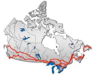 | |
| Alberta | ||
| Saskatchewan | ||
| Manitoba | ||
| Ontario | ||
| Quebec | ||
| New Brunswick | ||
| Prince Edward Island | ||
| Nova Scotia | ||
| Newfoundland | ||
| ||