Ruprechtshofen | |
|---|---|
 Coat of arms | |
 Ruprechtshofen Location within Austria | |
| Coordinates: 48°8′N 15°17′E / 48.133°N 15.283°E | |
| Country | Austria |
| State | Lower Austria |
| District | Melk |
| Government | |
| • Mayor | Leopold Gruber-Doberer |
| Area | |
| • Total | 30.57 km2 (11.80 sq mi) |
| Elevation | 247 m (810 ft) |
| Population (2018-01-01)[2] | |
| • Total | 2,315 |
| • Density | 76/km2 (200/sq mi) |
| Time zone | UTC+1 (CET) |
| • Summer (DST) | UTC+2 (CEST) |
| Postal code | 3244 |
| Area code | 02756 |
| Website | www.ruprechtshofen.at |
Ruprechtshofen is a town in the district of Melk in the Austrian state of Lower Austria.
Population
| Year | Pop. | ±% |
|---|---|---|
| 1971 | 1,065 | — |
| 1981 | 1,975 | +85.4% |
| 1991 | 2,116 | +7.1% |
| 2008 | 2,283 | +7.9% |
References
- ↑ "Dauersiedlungsraum der Gemeinden Politischen Bezirke und Bundesländer - Gebietsstand 1.1.2018". Statistics Austria. Retrieved 10 March 2019.
- ↑ "Einwohnerzahl 1.1.2018 nach Gemeinden mit Status, Gebietsstand 1.1.2018". Statistics Austria. Retrieved 9 March 2019.
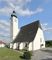
Parish church
This article is issued from Wikipedia. The text is licensed under Creative Commons - Attribution - Sharealike. Additional terms may apply for the media files.