Saint-Alban-sur-Limagnole | |
|---|---|
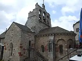 The church of Saint-Alban-sur-Limagnole | |
 Coat of arms | |
Location of Saint-Alban-sur-Limagnole | |
 Saint-Alban-sur-Limagnole  Saint-Alban-sur-Limagnole | |
| Coordinates: 44°46′55″N 3°23′21″E / 44.7819°N 3.3892°E | |
| Country | France |
| Region | Occitania |
| Department | Lozère |
| Arrondissement | Mende |
| Canton | Saint-Alban-sur-Limagnole |
| Intercommunality | Terres d'Apcher-Margeride-Aubrac |
| Government | |
| • Mayor (2020–2026) | Samuel Soulier[1] |
| Area 1 | 51.23 km2 (19.78 sq mi) |
| Population | 1,377 |
| • Density | 27/km2 (70/sq mi) |
| Time zone | UTC+01:00 (CET) |
| • Summer (DST) | UTC+02:00 (CEST) |
| INSEE/Postal code | 48132 /48120 |
| Elevation | 872–1,305 m (2,861–4,281 ft) (avg. 950 m or 3,120 ft) |
| 1 French Land Register data, which excludes lakes, ponds, glaciers > 1 km2 (0.386 sq mi or 247 acres) and river estuaries. | |
Saint-Alban-sur-Limagnole (French pronunciation: [sɛ̃.t‿albɑ̃ syʁ limaɲɔl]; Occitan: Sent Auban) is a commune in the Lozère department in southern France.[3] It is situated in the northern parts of the Lozère department.
See also
References
- ↑ "Répertoire national des élus: les maires" (in French). data.gouv.fr, Plateforme ouverte des données publiques françaises. 13 September 2022.
- ↑ "Populations légales 2021". The National Institute of Statistics and Economic Studies. 28 December 2023.
- ↑ INSEE commune file
Wikimedia Commons has media related to Saint-Alban-sur-Limagnole.
This article is issued from Wikipedia. The text is licensed under Creative Commons - Attribution - Sharealike. Additional terms may apply for the media files.