Saint-Cyr-le-Chatoux | |
|---|---|
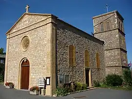 The church in Saint-Cyr-le-Chatoux | |
.svg.png.webp) Coat of arms | |
Location of Saint-Cyr-le-Chatoux | |
 Saint-Cyr-le-Chatoux  Saint-Cyr-le-Chatoux | |
| Coordinates: 46°01′38″N 4°33′24″E / 46.0272°N 4.5567°E | |
| Country | France |
| Region | Auvergne-Rhône-Alpes |
| Department | Rhône |
| Arrondissement | Villefranche-sur-Saône |
| Canton | Gleizé |
| Intercommunality | CA Villefranche Beaujolais Saône |
| Government | |
| • Mayor (2020–2026) | Jean-Pierre Dumontet[1] |
| Area 1 | 6.28 km2 (2.42 sq mi) |
| Population | 153 |
| • Density | 24/km2 (63/sq mi) |
| Time zone | UTC+01:00 (CET) |
| • Summer (DST) | UTC+02:00 (CEST) |
| INSEE/Postal code | 69192 /69870 |
| Elevation | 371–841 m (1,217–2,759 ft) (avg. 700 m or 2,300 ft) |
| 1 French Land Register data, which excludes lakes, ponds, glaciers > 1 km2 (0.386 sq mi or 247 acres) and river estuaries. | |
Saint-Cyr-le-Chatoux (French pronunciation: [sɛ̃ siʁ lə ʃatu]) is a commune in the Rhône department in eastern France.
See also
References
- ↑ "Répertoire national des élus: les maires" (in French). data.gouv.fr, Plateforme ouverte des données publiques françaises. 13 September 2022.
- ↑ "Populations légales 2021". The National Institute of Statistics and Economic Studies. 28 December 2023.
Wikimedia Commons has media related to Saint-Cyr-le-Chatoux.
This article is issued from Wikipedia. The text is licensed under Creative Commons - Attribution - Sharealike. Additional terms may apply for the media files.