Saint-Pierre-la-Palud | |
|---|---|
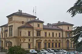 The Villa La Pérolliere | |
.svg.png.webp) Coat of arms | |
Location of Saint-Pierre-la-Palud | |
 Saint-Pierre-la-Palud  Saint-Pierre-la-Palud | |
| Coordinates: 45°47′30″N 4°36′44″E / 45.7917°N 4.6122°E | |
| Country | France |
| Region | Auvergne-Rhône-Alpes |
| Department | Rhône |
| Arrondissement | Villefranche-sur-Saône |
| Canton | L'Arbresle |
| Government | |
| • Mayor (2020–2026) | Morgan Griffond[1] |
| Area 1 | 7.53 km2 (2.91 sq mi) |
| Population | 2,587 |
| • Density | 340/km2 (890/sq mi) |
| Time zone | UTC+01:00 (CET) |
| • Summer (DST) | UTC+02:00 (CEST) |
| INSEE/Postal code | 69231 /69210 |
| Elevation | 259–747 m (850–2,451 ft) (avg. 360 m or 1,180 ft) |
| 1 French Land Register data, which excludes lakes, ponds, glaciers > 1 km2 (0.386 sq mi or 247 acres) and river estuaries. | |
Saint-Pierre-la-Palud (French pronunciation: [sɛ̃ pjɛʁ la paly]) is a commune in the Rhône department in eastern France.
Population
| Year | Pop. | ±% p.a. |
|---|---|---|
| 1968 | 1,385 | — |
| 1975 | 1,233 | −1.65% |
| 1982 | 1,546 | +3.28% |
| 1990 | 1,804 | +1.95% |
| 1999 | 1,983 | +1.06% |
| 2007 | 2,199 | +1.30% |
| 2012 | 2,607 | +3.46% |
| 2017 | 2,635 | +0.21% |
| Source: INSEE[3] | ||
See also
References
- ↑ "Répertoire national des élus: les maires". data.gouv.fr, Plateforme ouverte des données publiques françaises (in French). 2 December 2020.
- ↑ "Populations légales 2021". The National Institute of Statistics and Economic Studies. 28 December 2023.
- ↑ Population en historique depuis 1968, INSEE
Wikimedia Commons has media related to Saint-Pierre-la-Palud.
This article is issued from Wikipedia. The text is licensed under Creative Commons - Attribution - Sharealike. Additional terms may apply for the media files.