Saint-Genis-l'Argentière | |
|---|---|
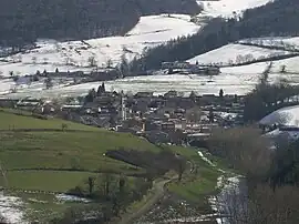 A general view of Saint-Genis-l'Argentière | |
.svg.png.webp) Coat of arms | |
Location of Saint-Genis-l'Argentière | |
 Saint-Genis-l'Argentière  Saint-Genis-l'Argentière | |
| Coordinates: 45°42′39″N 4°29′34″E / 45.7108°N 4.4928°E | |
| Country | France |
| Region | Auvergne-Rhône-Alpes |
| Department | Rhône |
| Arrondissement | Lyon |
| Canton | L'Arbresle |
| Intercommunality | Monts du Lyonnais |
| Government | |
| • Mayor (2020–2026) | Alexis Badoil[1] |
| Area 1 | 10.65 km2 (4.11 sq mi) |
| Population | 987 |
| • Density | 93/km2 (240/sq mi) |
| Time zone | UTC+01:00 (CET) |
| • Summer (DST) | UTC+02:00 (CEST) |
| INSEE/Postal code | 69203 /69610 |
| Elevation | 330–860 m (1,080–2,820 ft) (avg. 480 m or 1,570 ft) |
| 1 French Land Register data, which excludes lakes, ponds, glaciers > 1 km2 (0.386 sq mi or 247 acres) and river estuaries. | |
Saint-Genis-l'Argentière is a commune in the Rhône department in eastern France.
See also
References
- ↑ "Répertoire national des élus: les maires" (in French). data.gouv.fr, Plateforme ouverte des données publiques françaises. 13 September 2022.
- ↑ "Populations légales 2021". The National Institute of Statistics and Economic Studies. 28 December 2023.
Wikimedia Commons has media related to Saint-Genis-l'Argentière.
This article is issued from Wikipedia. The text is licensed under Creative Commons - Attribution - Sharealike. Additional terms may apply for the media files.