Saint-Pé-Saint-Simon | |
|---|---|
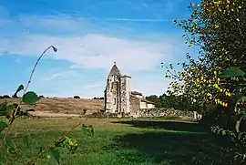 The church in Saint-Pé-Saint-Simon | |
Location of Saint-Pé-Saint-Simon | |
 Saint-Pé-Saint-Simon  Saint-Pé-Saint-Simon | |
| Coordinates: 44°00′13″N 0°06′09″E / 44.0036°N 0.1025°E | |
| Country | France |
| Region | Nouvelle-Aquitaine |
| Department | Lot-et-Garonne |
| Arrondissement | Nérac |
| Canton | L'Albret |
| Government | |
| • Mayor (2020–2026) | Michel Sabathier[1] |
| Area 1 | 17.46 km2 (6.74 sq mi) |
| Population | 189 |
| • Density | 11/km2 (28/sq mi) |
| Time zone | UTC+01:00 (CET) |
| • Summer (DST) | UTC+02:00 (CEST) |
| INSEE/Postal code | 47266 /47170 |
| Elevation | 73–161 m (240–528 ft) (avg. 120 m or 390 ft) |
| 1 French Land Register data, which excludes lakes, ponds, glaciers > 1 km2 (0.386 sq mi or 247 acres) and river estuaries. | |
Saint-Pé-Saint-Simon (French pronunciation: [sɛ̃ pe sɛ̃ simɔ̃]; Gascon: Sent Pèr e Sent Simon) is a commune in the Lot-et-Garonne department in south-western France.[3]
See also
References
- ↑ "Répertoire national des élus: les maires". data.gouv.fr, Plateforme ouverte des données publiques françaises (in French). 2 December 2020.
- ↑ "Populations légales 2021". The National Institute of Statistics and Economic Studies. 28 December 2023.
- ↑ INSEE commune file
Wikimedia Commons has media related to Saint-Pé-Saint-Simon.
This article is issued from Wikipedia. The text is licensed under Creative Commons - Attribution - Sharealike. Additional terms may apply for the media files.